
Bernese Oberland Traverse | Complete Guide
Everything you need to plan, book and self-guide this extraordinary multi-day hike through the Swiss Alps
The Bernese Oberland traverse takes you through some of the most beautiful mountain scenery in the Swiss Alps. It is an incredibly diverse hike, allowing you to visit bustling alpine villages, areas of outstanding natural beauty, rugged and remote mountain passes and locations steeped in mountaineering and literary history. It also allows you to gain a special insight into Swiss mountain culture, hearing the cowbells, tasting the cheese and chocolate, riding the yellow postbus! Unlike long distance routes such as Tour du Mont Blanc, the Bernese Oberland Traverse does not have one recognised trail. Moreover, it is a network of trails with multiple options to suit the tastes and aspirations of hikers who choose to tackle the traverse.
KEY TRAIL STATS FOR “CLASSIC” ROUTE

Bernese Oberland Traverse: High level map from our planning app showing the trail travelling between Meiringen and Leukerbad, Switzerland. The city of Interlaken to the North, and Geneva to the West.
Country: Switzerland
Number of days: 5 - 8 days
Distance: 102km / 63mi
Elevation gain: 7,200m / 23,700ft
Highest point: 2,778m / 9,114ft (Hohtürli pass)
Season: Early: Mid-Jun to End Jun. Peak: Start Jul to End Aug. Late: Sept
Difficulty: Moderate
Start location: Meiringen
End location: Leukerbad
IS THERE ONLY ONE BERNESE OBERLAND TRAVERSE?
Descending towards Hohtürli Pass
The Bernese Oberland Traverse connects the north-eastern edge of the mountain range at Meiringen with the south-western edge at Leukerbad. It traverses, more or less, the canton of Bern from its border with Unterwalden to the border with Valais. Sections of the traverse have important historical significance as routes used by traders and farmers to connect valleys and indeed cantons before the advent of motor vehicles and modern-day road networks. Parts of the route and many of the trail highlights also have significance as major tourist attractions in the late nineteenth and early twentieth century, when the Alps were an important part of the "Grand Tour" of Europe for the wealthy. Evidence of this can be seen amongst the many hotels and attractions, such as the mountain railways, which date back to the 1800s.
Classic trail highlights
Rychenbach Falls is a roaring cascade which tumbles down the mountainside above Meiringen. The falls were made famous as the location of the mysterious disappearance of Sherlock Holmes in Sir Arthur Conan Doyle's novels.
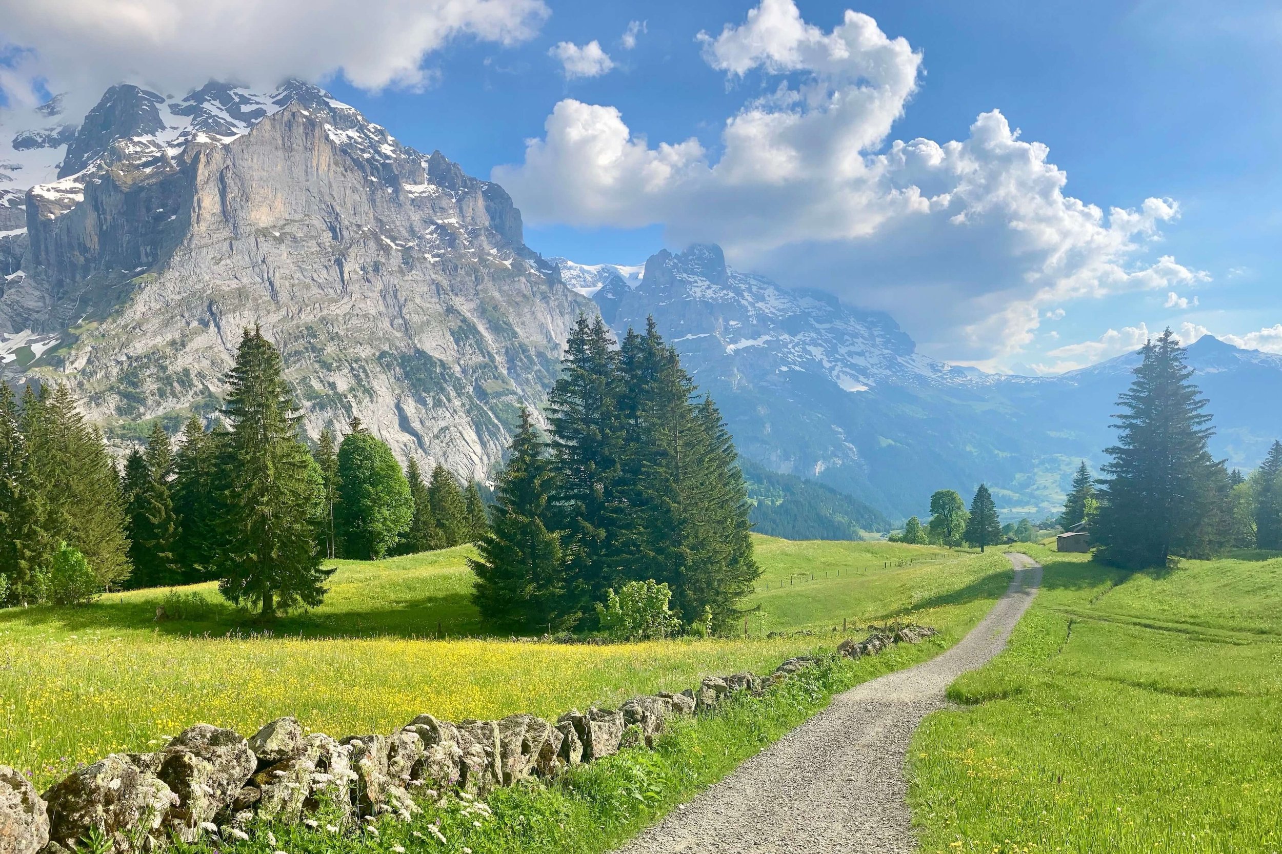
Grosse Scheidegg provides wonderful views of The Wellhorn and Wetterhorn with the Eiger visible in the distance. It was originally used by farmers and traders to drive cattle and transport goods between the valleys and indeed, neighbouring cantons.
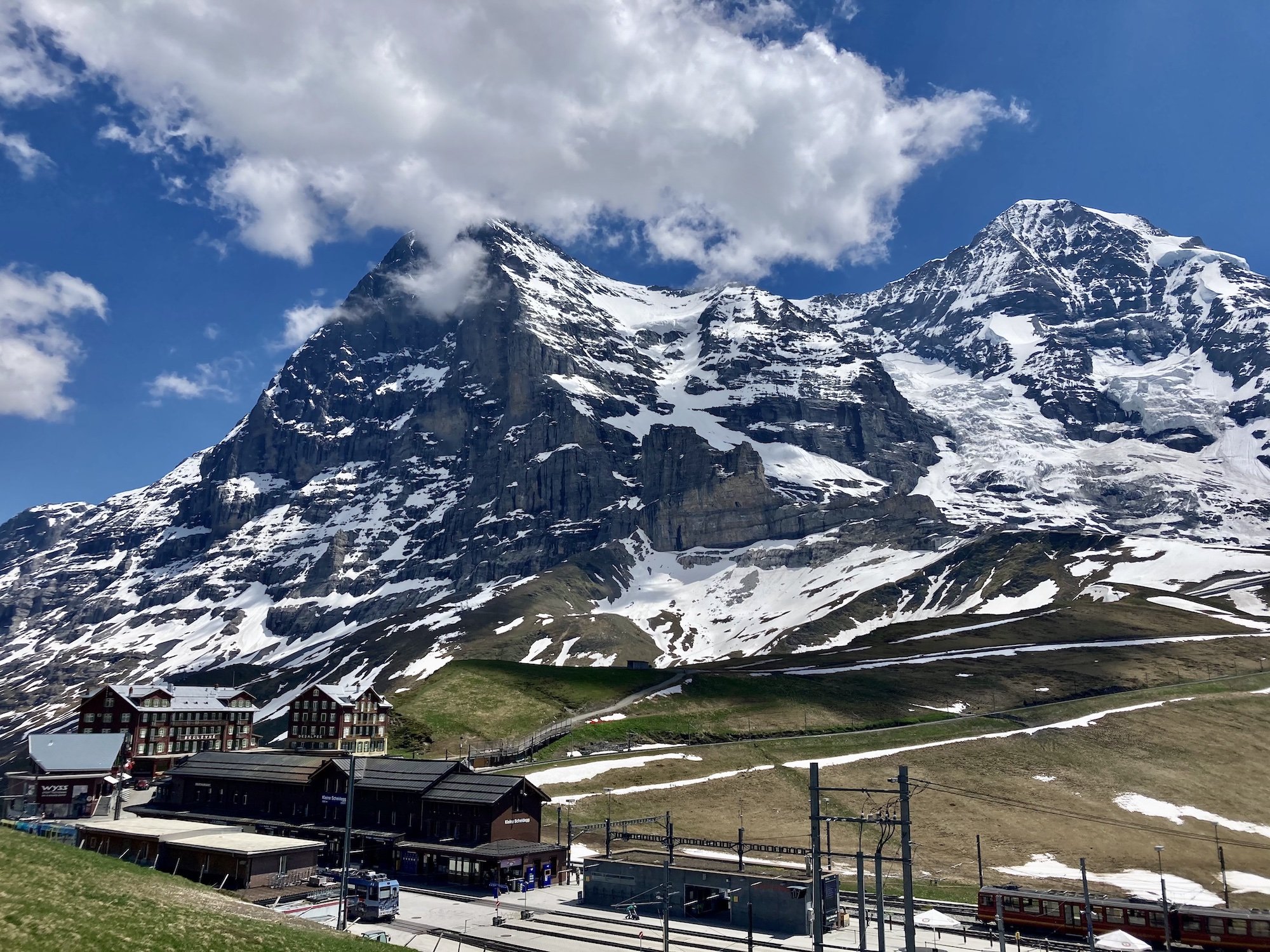
Kleine Scheidegg has a long and interesting history with the Belle Vue Hotel opening in 1840 and a cogwheel railway being constructed at the end of the same century. There is a busy little station at the pass and it is from here that visitors cans set off on the train which climbs up through The Eiger and emerges at the Jungfraujoch, 1400m above.
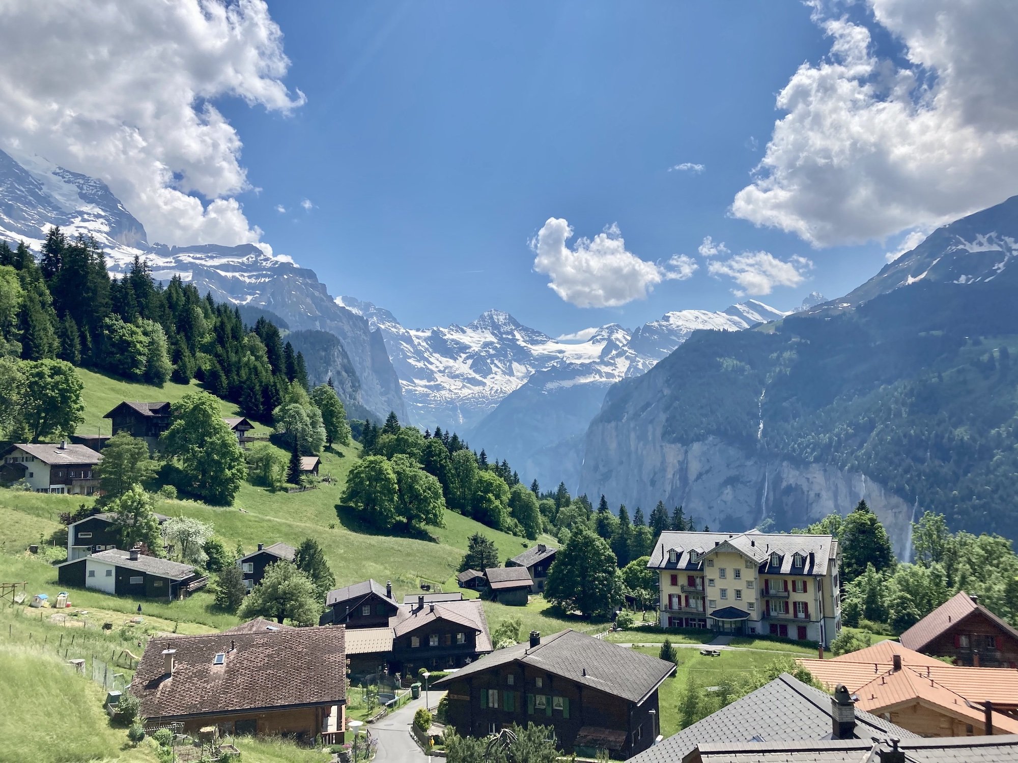
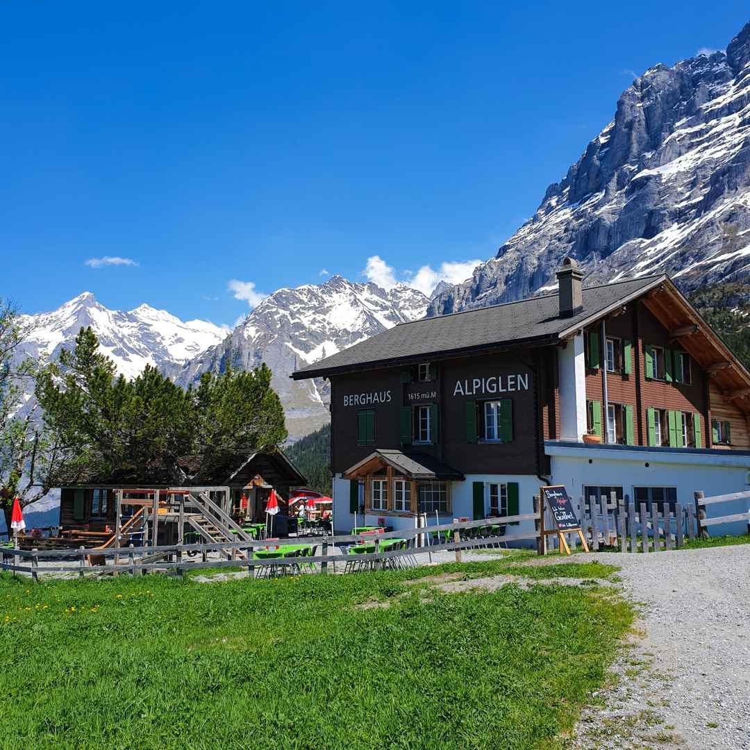
Swiss alpine villages, including Wengen and Murren are situated on high alpine pastures and inaccessible by automobile. This makes for a wonderfully peaceful ambiance and a feeling of stepping back in time.

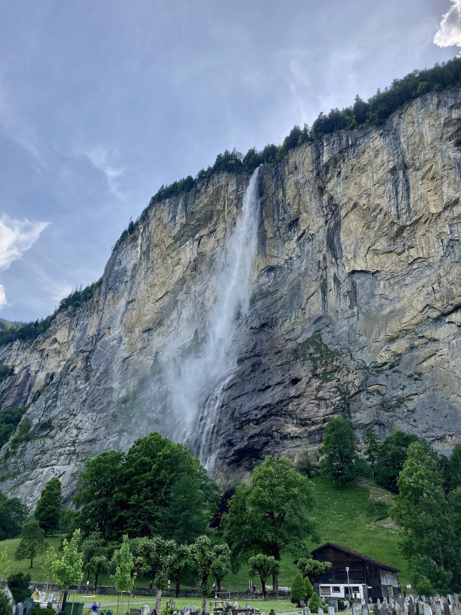
Staubbach Falls is the first large waterfall that greets you as you enter the Lauterbrunnen valley. It plunges vertically over 200m from the cliffs above. It is situated right next to the village of Lauterbrunnen and there are steps and a tunnel which take you up into the cliff, directly behind the falls - it may be worth wearing your rain jacket!
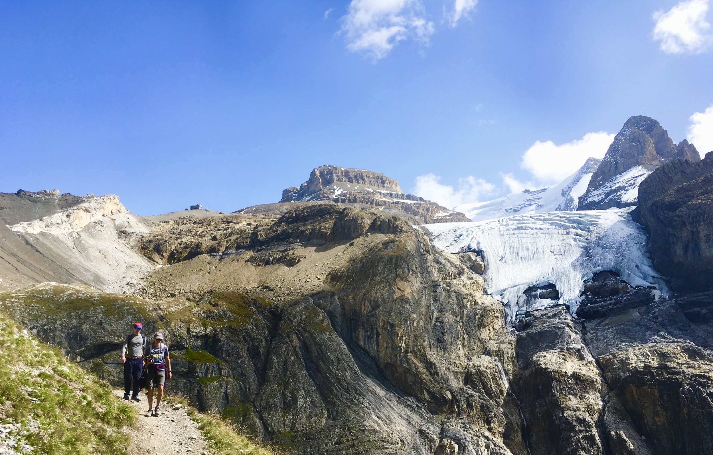
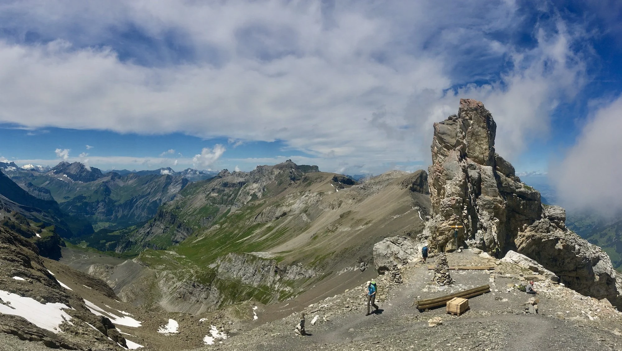
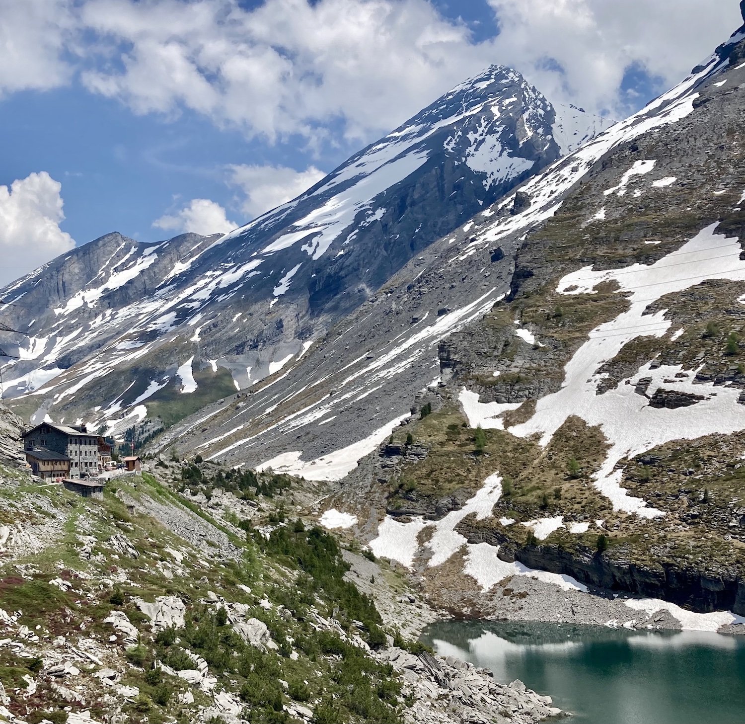
The Hohtürli pass is the highest point at 2,777m on the route. Take your time and enjoy the unparalleled views, the proximity of the glaciers and bask in the glory of having achieved a tough climb!
Oeschinensee is one of the most beautiful lakes in the Alps. The colour of the lake is out-of-this-world and the north flank of The Doldenhorn makes a suitably impressive backdrop.
Gemmipass has great historic significance as an important crossing point between the cantons of Bern and Valais. The route drops 900m down to Leukerbad below via a path which cleverly winds it’s way down the mountainside and deposits you in the old spa town, ready to take a soak in the thermal waters and celebrate the completion of the traverse.

HOW LONG DOES IT TAKE TO HIKE THE BERNESE OBERLAND TRAVERSE?
It typically takes between 5 and 8 days to complete the Bernese Oberland Traverse.
It depends on which route you decide to take, where you decide to stay each night, your hiking speed, the desired number of hiking hours per day and whether you will use transport to skip ahead on the trail.
Some hikers are up at the crack of dawn and will arrive at their accommodation in time for dinner, having hiked for 8+ hours. Whereas others prefer a slow start, long lunch at mountain hut and an early arrival at their location, having hiked 4-5 hours.
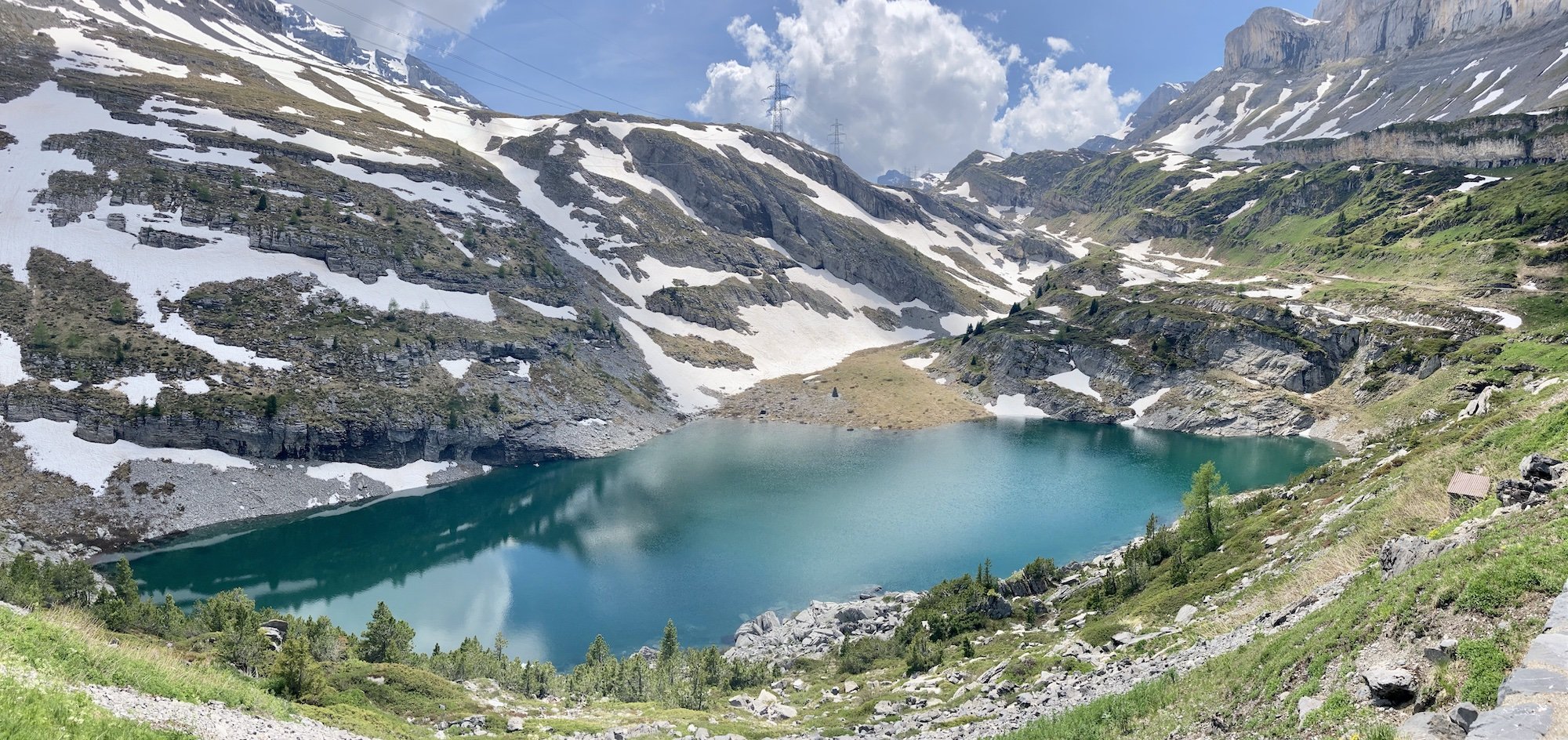
The lovely view looking down onto the mountain lake below Schwarenbach
WHERE DOES THE BERNESE OBERLAND TRAVERSE START?
Meiringen is the normal starting point as it is on the very eastern edge of the Bernese Oberland and has a train station and good transport links. Along with the nearby Rychenbach Falls, Meiringen features as a significant location in one of the Sherlock Holmes novels.
Meiringen has several outdoor shops if you need to purchase any outdoor clothing or equipment before setting off. There are also several cash points (ATMs) and small supermarkets near the station including Migros and The Co-op.
Meiringen is not a large town with a great deal to see but if you choose to arrive in advance of the main hike, there are some options for day hikes to help acclimatise to the area.
For those with less time to spare? Grindelwald also makes a convenient start location, as does Lauterbrunnen. Using Lauterbrunnen means that you are starting approximately halfway through the full tour.

Meiringen, the start point of the Bernese Oberland Traverse

Choose Meiringen trailhead as your start/end in our planning app for accurate daily hiking stats and transport options to reach the trailhead.
WHERE DOES THE BERNESE OBERLAND TRAVERSE END?
The Bernese Oberland Traverse ends in Leukerbad, on the south-western edge of the range. It is an old spa town (the highest in Switzerland) where you can soak your trail-weary muscles in one of the naturally occurring hot springs.
From Leukerbad there are buses to the Rhone Valley below and then regular trains to Geneva International Airport.

Leukerbad, the end point of the Bernese Oberland Traverse

Choose Leukerbad trailhead as your start/end in our planning app for accurate daily hiking stats and transport options to reach the trailhead.
WHAT TYpe of accommodation is available on the Bernese Oberland Traverse?
Hikers have the opportunity to stay in both alpine villages and mountain huts along the trail.
For those that haven’t experienced staying in a mountain hut - also known as refuges (German) - this is your opportunity. Sleeping amongst the mountains, indulging in local cuisine and meeting other hikers is a unique experience not to be missed.
Over 100 accommodation locations are listed our trip planning app.
Some of the most popular huts along the Bernese Oberland Traverese include:


Is it possible to camp along the bernese oberland traverse?

Typical wild camping spot along the Bernese Oberland Traverse
Yes, it is possible to bivouac or "wild camp" or stay in campgrounds in villages and the valleys along the route. There are strict rules put in place by the national and local governments for those who wish to bivouac. Due to the prevalence of private land (high alpine farms/ski resorts), protected wildlife reserves, and inhospitable slopes for sleeping, there are a limited number of locations along the route that are suitable for bivouacking/wild camping.
As a general rule, you should aim to camp above the treeline and the alpine pastures, keeping clear of working farms and livestock. You should only stay one night in one location, setting up your tent in the evening and taking it down promptly the next morning to move on to your next destination.
It goes without saying to leave no trace and be careful not to pollute any nearby water courses. If you wish to camp near a mountain hut (to enjoy the added security and possible amenities) you should seek permission from the hut warden and possibly pay a small fee.
Details of bivouac locations will be available within The Hiking Clup App soon.
Which direction to hike the Bernese Oberland Traverse?
The majority of people hike The Bernese Oberland Traverse from east to west. This affords a more gentle warm up with the higher, more challenging passes being crossed in the latter stages of the traverse.

Hiking towards First Station with the Wetterhorn behind
When is the hiking season for the bernese oberland traverse?
Most people do not start the Bernese Oberland Traverse before early July.
In June there is usually still a lot of snow on the high passes of Sefinafurgga and Hohtürli which may prohibit a safe passage. This varies from year to year depending on the quantity of winter snowfall and how quickly it melts in the spring. Some mountain huts will tend to open once the majority of snow has melted from paths that are used to access them (mid-late June). Others, such as Gspaltenhornhütte and Blüemlisalphütte, will open regardless around mid June (especially Swiss Alpine Club huts) as they also service mountaineers who have special equipment and are using the huts to access the surrounding high peaks. If these huts are open, it doesn't necessarily mean they are accessible for hikers with basic equipment. It's best to check for details about conditions on their website or get in touch with them directly for more info.
The mountain huts tend to start closing in late September and there are often good hiking conditions throughout September. However, storms become more frequent, days are shorter and night-time temperatures cooler.

Typical early season hiking conditions (June)

Typical peak season hiking conditions (July - August)

Typical late season hiking conditions (September)
what type of terrain is the bernese oberland traverse?
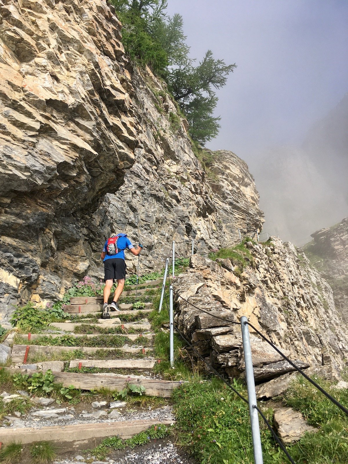
The Bernese Oberland Traverse is around 65% mountain trail and 35% regular hiking trail. There is no alpine trail on the main trail or the variants. The percentage of mountain trails increases if you choose more of the variants.

Example of a hiking trail

Example of a mountain trail
ARE THERE TRANSPORT SHORTCUTS ON THE BERNESE OBERLAND TRAVERSE?
It is possible to shorten the Bernese Oberland Traverse by taking public transport options, including cable car, bus and train. These options can help to minimise the hiking time on a specific day (i.e cable car on ascent/descent) or to skip forward a day (i.e bus/train).

Option to catch a train from Kleine Scheidegg to skip forward
Use our trip planning app to discover transport schedules and costs for the upcoming season.
what are the alternate route options on the bernese oberland traverse?
There are many alternative routes to include additional highlights, avoid challenging sections of trail or skip highlights on the main trail by going more direct. Details of these alternate routes are available within our trip planning app.
The most popular alternate routes along the Bernese Oberland Traverse, include:
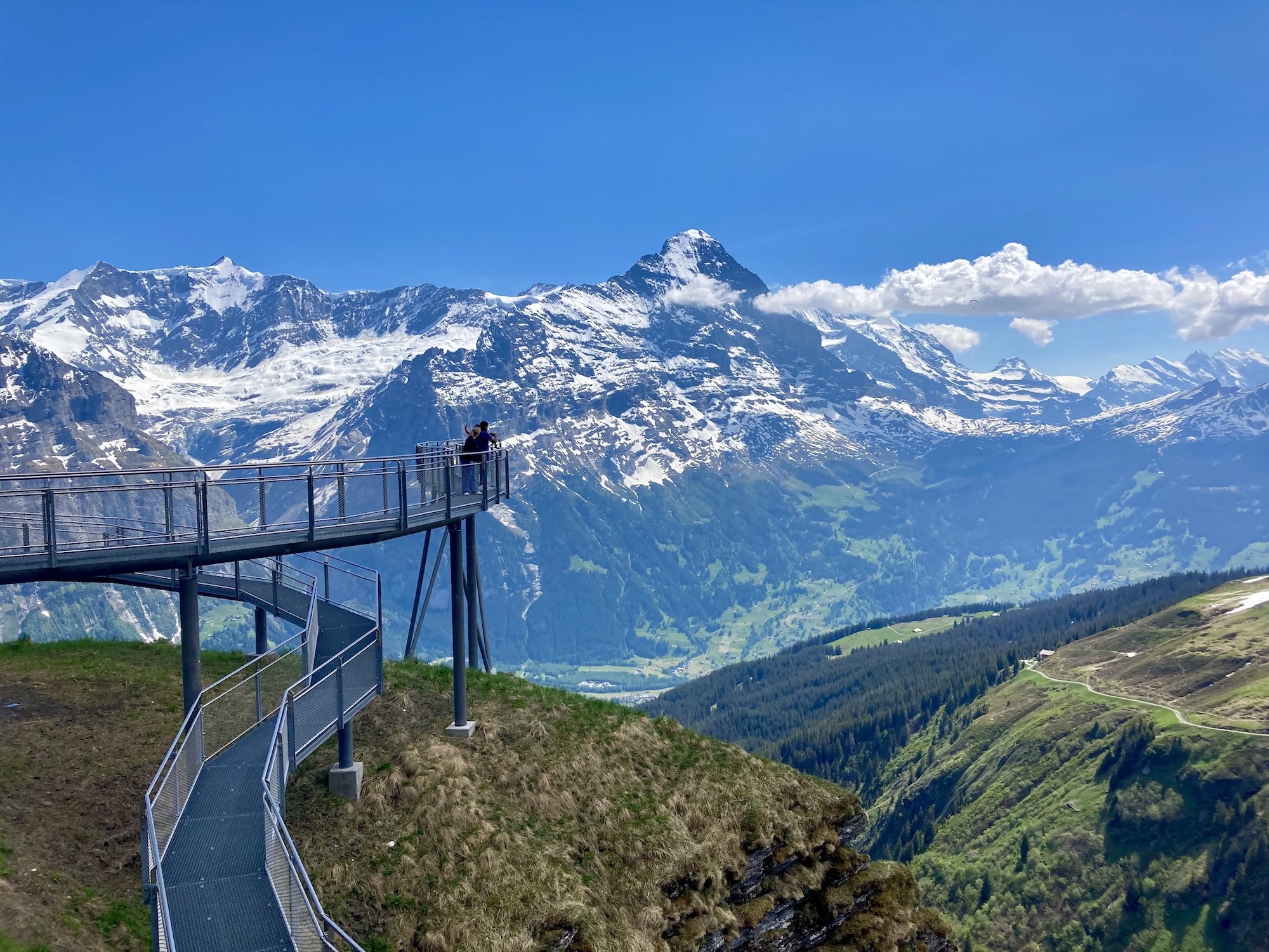
The First cliff walk takes you on an impressive metal walkway, bolted to the sheer cliff face, with a vertical drop of a hundred metres right beneath your feet.
The Eiger Trail traverses directly beneath the mighty north face of The Eiger. It is possible to spot many of the features on the route taken by the first ascensionists: the White Spider, the Hinterstroisser Traverse and Death Bivouac, to name a few! You can also spot the “Gallery Windows”, where the train inside the mountain stops to allow passengers a view into the void!
Mannlichen offers a great viewpoint of the Eiger, Monch and Jungfrau mountains, three of the principle peaks of the Bernese Oberland. One also gets a birdseye view of the Lauterbrunnental and your destination, the village of Wengen, far below.
Trummelbach Falls uses a series of cleverly constructed walkways and stairs, to view many of the waterfalls and plunge pools. Some of the falls are so deep inside the mountain that there is no daylight and they are artificially illuminated.


Obersteinberg Mountain Hotel is like a step back in time. The hotel has been operating (during the summer season) since the 1880s and little has changed since then. There is no electricity and you are provided with a candle to illuminate your room after dark. Dinner is a rustic and hearty affair, typical mountain cuisine, and also candle lit.
Gspaltenhornhutte is a rugged and remote location in the heart of the mountains with a great terrace from which to view the Gamchigletsher far below and if you're lucky, enjoy some alpenglow on the Morgehorn, directly across from the hut.
Doldenhornhutte gets you off the beaten track and offers a quieter option, away from the hustle and bustle of the valley down below. There are great views westward of the Bunderspitz and Gross Loner. The hut is relatively small and cosy and it is a good place to enjoy a cold beer at sunset and chat with other hikers and climbers over the communal dinner.
The Uschenegrat ridge walk has a bit of everything. At the start of the ridge there is the summit of The Gallihorn with 360 degree views. Afterwards, the trail tends to stay slightly to the right of the ridge proper but is a lovely traverse. Finally, you drop down through a flower-filled pasture complete with a small mountain lake.
Full details of these alternate routes are available within our trip planning app.


