Tour of Chamonix Peaks


Tour of Chamonix Peaks
See the Alps in all their glory from key peaks in the Chamonix region. No climbing gear required, just a sense of adventure!
Number of days: 3
Av. daily hiking time: 7 hours 30 mins
Av. daily hiking distance: 17km / 11mi
Av. daily elevation gain: 1,589m / 5,212ft
Tour details
Across three epic days, you will hike to mountain passes and peaks that provide views across the Mont Blanc Massif, Haute Savoie region and Swiss Alps. The route has a lot of variety; well-maintained hiking trails, rocky scrambles, and narrow balcony paths. Due to the elevation of some peaks and sections of trail, you may also need to cross residual or new snow; even during the summer months.
Starting with a border crossing from France to Switzerland via a mountain pass, hikers will walk a dramatic ridgeline that looks across the Trient Valley and Bernese Oberland.
Next, the ascent of Mont Buet (3,096 m / 10157ft) is not for the faint-hearted. Hikers must climb 1,700m / 5,577ft from the valley floor to reach the rocky (and potentially snowy) summit. You will be rewarded with views across Emosson Dam, Mont Blanc Massif, and the Savoy Prealps region.
The final day takes a gradual climb to the highest point on the main Tour du Mont Blanc trail, walking the famous Grand Balcon Sud. Hikers end the tour at Le Brevent standing directly opposite the Mont Blanc peak, Glacier de Taconnaz and Glacier des Bossons.
Note: This tour requires a one-way cable car and gondola ride. Tickets can be purchased on the day at the top of the cable car station. No climbing gear or experience is required to reach passes or peaks.
Tour highlights
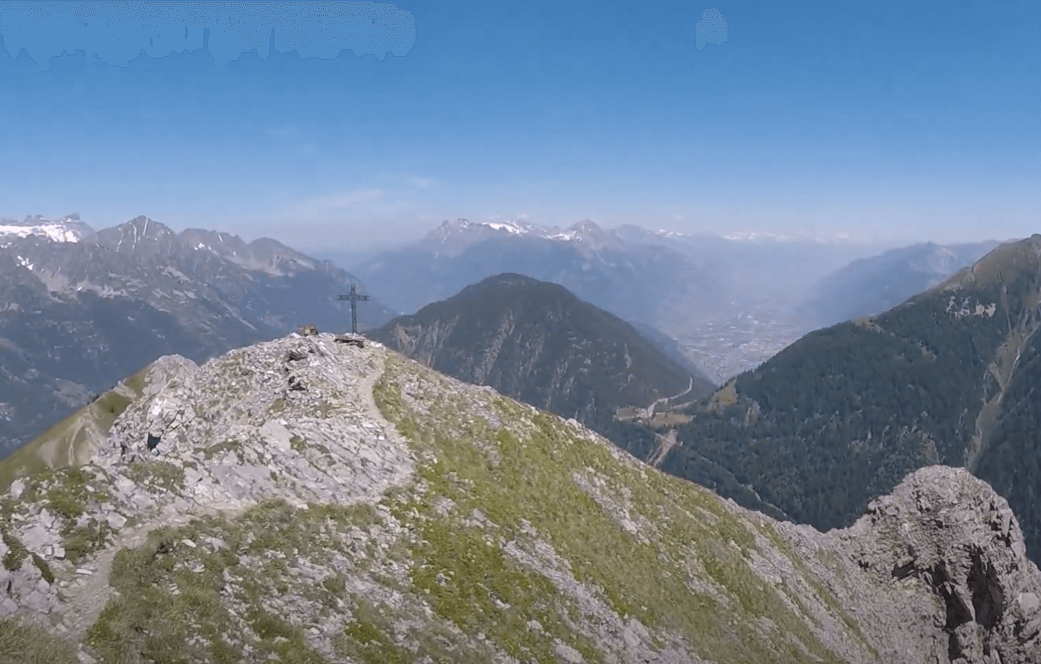
Croix de Fer: A dramatic ridge line that looks across the Trient Valley and Bernese Oberland.

Col de Balme: This high mountain pass sits at 2195m / 7201ft and is located on the border between France and Switzerland, separating the Chamonix Valley and Trient Valley.
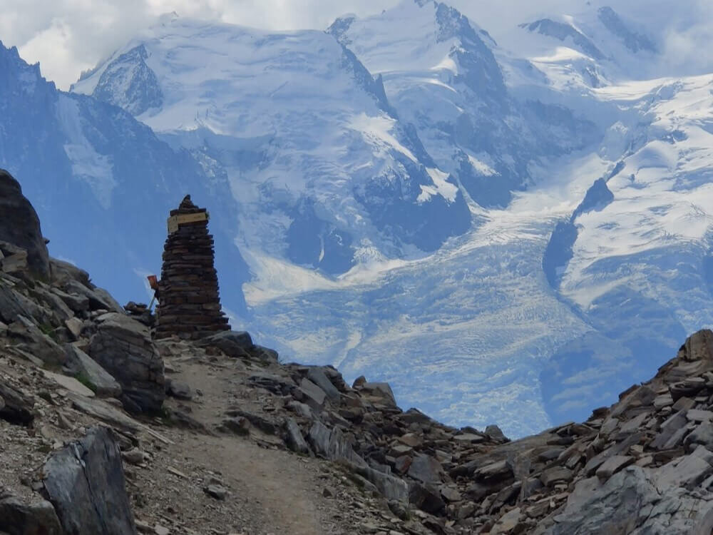
Mont Buet: At 3,096 m / 10157ft, this mountain peak rewards hikers with views across Mont Blanc Massif and the Savoy Prealps region.

Eau de Berard: This river is fed by the Glacier de Berard and follows the valley on the route to Mont Buet.
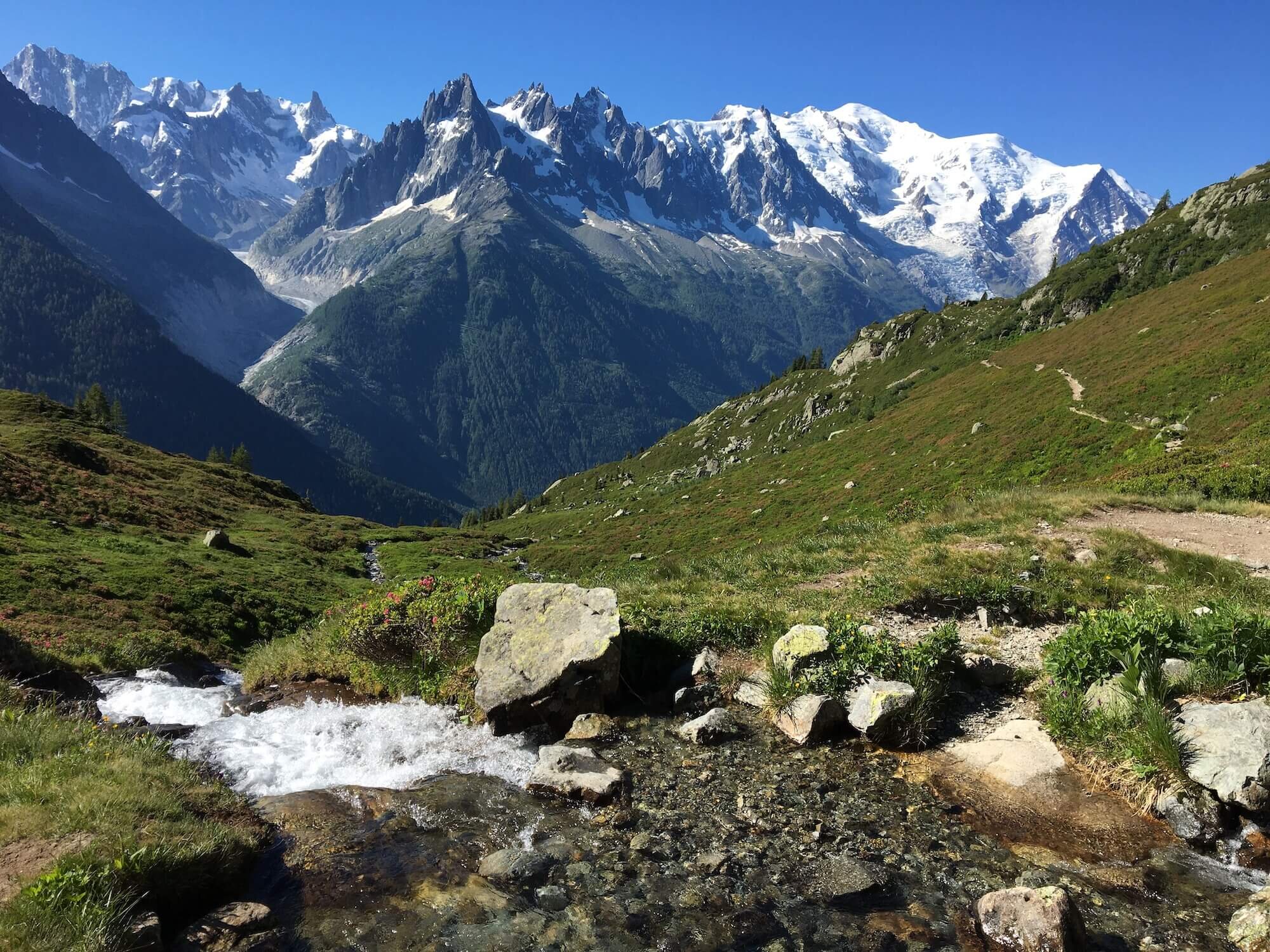
Grand Balcon Sud: A balcony trail runs above the Chamonix valley, providing hikers with views of the entire North West facing side of Mont Blanc massif.
Col du Brevent: This mountain saddle sits opposite the Mont Blanc massif and lets you peak into the nature reserve of Sixt-Passy in the Savoy Prealps region.
Base camp details
This tour uses Chamonix as its base camp. The trail is continuous but returns to the valley each night. We recommend you book the same accommodation in Chamonix or within the valley for the duration of the tour for ultimate convenience. Each day begins and ends 30-45 minutes from Chamonix via public transport. Full details of trailhead locations, transport schedules, and accommodation options are provided upon purchase.

