Hiking Around Sydney, Australia

While more famously known for its beaches, harbour and architectural icons, Sydney also has a rich history and culture of hiking. Due to the proximity and protection of several heritage listed national parks, Sydney is on the doorstep of a vast network of accessible and diverse hiking trails or ‘bushwalks’ as they are locally known.

Australia has thousands of national parks and conservation reserves, with over 880 protected areas in Sydney and New South Wales alone. They serve to protect the diversity of Australian native landscapes, including everything from deserts to rainforests, coastal ecosystems and eucalypt woodlands, and are filled with hundreds of hiking trails and adventure activities. 

The national parks around Sydney are places of conservation and protection for the unique native plants and wildlife that inhabit them. However, many of Sydney’s national parks were originally designated as places for walking, recreation and leisure. 

The Coastal Track, Royal National Park, south of Sydney

The concept of national parks in Australia hailed from England’s royalty who set aside large areas of land for their own recreational pursuits. In the 19th century, Australia, as a relatively new country, had a rapidly expanding colony in Sydney that was surrounded by untouched bushland that was perfect for the entertainment of its growing population.

The world’s second oldest national park

To encourage its city dwelling inhabitants to experience the health benefits of nature, Sydney established the world’s second oldest national park in 1879, aptly named, National Park (Yellowstone in the US was the first, established in 1872). In 1955 the park was renamed The Royal National Park after Queen Elizabeth II passed through on the train to Wollongong during her 1954 tour of Australia. In true Aussie fashion, it is sometimes locally referred to as the ‘Nasho’.

The Coastal Track, The Royal National Park, south of Sydney

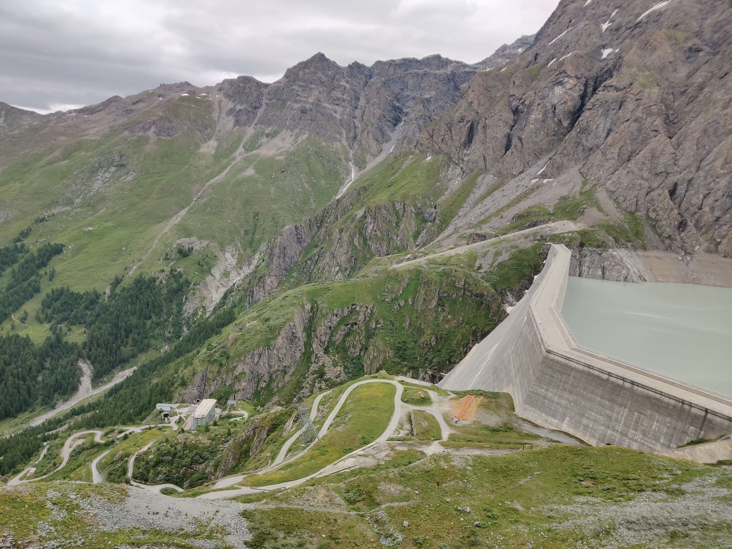
The Royal National Park covers 15,000 hectares along Sydney’s south east coastline from the Port Hacking River (near Cronulla) down to the southern tip at Otford. Its many hiking trails provide access to panoramic views from coastal cliffs, secluded beaches, rock shelves and rock pools, rainforests and valley creeks, mudflats and salt marsh, and a heathland of salt-tolerant scrub. 

When the train lines were built to access the Royal National Park, visitation grew from 38,000 in 1892 to 170,000 in 1903. Just seven years later, annual visitor numbers had reached 250,000 (National Museum Australia). Within this growing number of people who appreciated the Australian bush in its untouched glory was Myles Dunphy (1891–1985).

A passionate hiker, Dunphy founded Sydney’s first hiking club, The Sydney Bush Walkers and in doing so coined the term “bushwalking”, a word that is now synonymous with hiking in Australia. See these early photographs recently acquired by The State Library of the early expeditions and members of the Sydney Bush Walkers Club from the 1920s and 30s.

Myles Dunphy. Photo: Colong Foundation, NSW Teachers Federation.

Dunphy is considered one of Australia’s earliest campaigners for environmental conservation and believed the preservation of nature was crucial for the wellbeing of modern society. He had a vision for protecting the land from development for current and future generations (NSW Teachers Federation) and led the “bushwalking conservation” movement that rose to prominence during the Depression of the 1930s, promoting walking in nature as an inexpensive and accessible sport.

Bushwalking conservation

Dunphy spent a lifetime walking, mapping and advocating for the establishment of national parks, most notably resulting in the creation of the Blue Mountains National Park in 1959. Sprawling over 260,000 hectares of pristine wilderness, The Greater Blue Mountains National Park is the largest park nearest to Sydney, and was inscribed on the World Heritage List in 2000. With a huge network of trails, The Blue Mountains is a hikers paradise. 

The Undercliff Track between Wentworth Falls and Leura, Blue Mountains National Park. Photo: The Hiking Club

The Blue Mountains National Park is part of the Great Dividing Range, running along the East Coast of Australia. You can see why it was a favourite of Dunphy and The Sydney Bush Walkers club, there is so much to discover including scenic lookouts across undulating mountains, waterfalls diving off sandstone escarpments, historic walking tracks through lush rainforest valleys, and a rich ancient Aboriginal history told through important cultural sites.

The Blue Mountains have many geological landforms as well as species of plants that are found nowhere else in the world and are survivors from the time of the Gondwana supercontinent, like the beautiful but incredibly rare Euphrasia bowdeniae, or the special Fletcher’s Drumstick that grows halfway up the cliffs on vertical sandstone rock faces. Protecting these and other species, like the Dwarf Mountain Pine of which there have only been 755 plants recorded and has survived in this unique environment since the time of the dinosaurs, is a key role of the Blue Mountains National Park. Read more about the incredible formation of the Blue Mountains and Sydney’s natural landscape here.

Blue Mountains Cliff Eyebright or Euphrasia bowdeniae grows in small packets of damp, sandy soil on ledges or vertical sandstone rock faces and is endemic to The Blue Mountains. Photo: Daniel Parsons.

Isopogon fletcheri, commonly known as Fletcher's drumsticks, is a species of plant in the Proteaceae family and is endemic to a small area in the Blue Mountains National Park. Photo: Daniel Parsons.

Cultures past, present and future

In addition to remarkable biodiversity, the national parks around Sydney have important cultural and historic value. As the land of one of the oldest civilisations on the planet, the natural features of these ancient landscapes are of irreplaceable significance to Australia’s First Nations Peoples. Many Aboriginal sites are still used today as part of their living culture. 

The national parks to the north of Sydney are home to a number of significant Aboriginal sites and artefacts including middens, rock carvings, paintings and sacred areas. These sites are part of the deep connection Aboriginal people have with the landscape, one that has existed immeasurably longer than they have been in a National Park. 

The Warrimoo Track follows the beautiful Cowan Creek in the Ku-ring-gai Chase National Park north of Sydney.

There are several Aboriginal midden sites along the foreshore in Ku-ring-gai Chase National Park to the north of Sydney. The Aboriginal custodians of this land, the Guringai peoples, hunted and gathered on the foreshores of the network of rivers in this area (visit the Aboriginal Heritage office website for a detailed history of the land in this area). Middens are shell mounds built up over hundreds and often thousands of years as a result of countless meals of shellfish. They vary in shape and size, from a few scattered shells to deposits that are metres thick and buried under vegetation. They differ from natural shell deposits as they often include campfire charcoal, stone flakes and remains of stone tools. 

Hiking and protecting parks around Sydney

The view across Berowra Creek from Naa Badu Lookout along The Great North Walk in Berowra National Park.

There are several national parks north of Sydney, but the most accessible include Ku-ring-gai Chase National Park, Berowra Valley National Park and Lane Cove National Park. Established in 1894, Ku-ring-gai Chase National Park is Australia’s second oldest national park, and combines important history and cultural treasures with scenic beauty. 

Established in 1894, the park is almost 15,000 hectares, a significant size considering it is only 32km from Sydney city centre. Berowra Valley National park includes a 25 km section of the Great North Walk, a 260 km multi-day walk from Newcastle to Sydney. Discover a pocket of bushland filled with native birdlife right on Sydney’s doorstep in the Lane Cove National Park. Explore Sydney Harbour’s staggering coastline and islands along an endless network of coastal trails within Sydney Harbour National Park. 

The view across the Jamison Valley from Olympian Rock, Blue Mountains National Park.

Hiking and bushwalking in Sydney is so accessible and diverse due to the proximity and protection of these heritage listed national parks. Given Australia has experienced the largest documented decline in biodiversity of any continent over the past 200 years and climate change is posing a bigger threat than ever before, it is more important than ever that we protect the land that we have the privilege of walking on (read more about that here and here). 

As Myles Dunphy recognised while hiking around Sydney more than a century ago, ‘we need these wild, beautiful places to maintain our mental, physical and spiritual wellbeing’ (NSW TF). While we continue to protect our national parks, let’s get out there and use them! Walking our local trails shows our local governments that we value our parks, so they can remain available to us and future generations.


Author: Greta Stevens
Greta discovered a love for multi-day hiking on the Camino de Santiago and has never looked back. She co-created the Modern Adventurers book with The Hiking Club before joining the team full time to help empower a global community of adventurers to walk the way they want in the wild!


WHO ARE WE?

The Hiking Club empowers anyone to walk the way they want in the wild with personalised self-guided hiking experiences that are easy to find, quick to plan and simple to navigate.

We believe hiking experiences have the power to transform lives. With a growing range of personalised hikes that take into account your preferences, fitness and interests, we give you everything you need to explore the legendary trails of the world!

Join our global hiking community!


Camaraderie on the trail

Graeme McIlveen, Fergus Ring and Frank Osborn from Australia hiked the Walker’s Haute Route in 2019 to build their fitness, multi-day hiking experience, and friendship.


Lifelong friends make great hiking comrades.

“As three friends from Australia, aged 72, 69 and 63, we got to know each others’ abilities, strengths and weaknesses while hiking the Kumano Kodo pilgrimage trail in Japan in 2017, and were keen to participate in another trek. All three of us have past experience of different cultures through our work and on our own individual treks, and liked the thought of getting fit for another challenge. We also wanted to remain as peripheral adventurers (and without stressing our spouses too much). The Walker’s Haute Route sounded like a good fit.

This trail was going to be the longest trek that any of us had undertaken. We planned for a 14-day journey, knowing that any disappointment or setback of the day could be compensated by a nice beer, followed by a wine and a Swiss dinner afterwards.

Enjoying a well deserved drink after a tough day on the trail.

We were committed to commencing our trek rather early in the season and unfortunately, we were exposed to late Spring snow causing considerable concern, as none of us had prior experience alpine trekking. However, we planned with optimism. We never view a trek as a failure if there is still culture, amazing vistas and good friendship to be included.

With the help of The Hiking Club, we could assess the next day’s section of trail and judge our capability to deal with the particular conditions of the pass we were to cross, or choose an alternative transport option and go by car, bus or train to the next valley. There were a couple of sections that really tested the height of our skill level, in particular, the deep snow and steep incline to Cabane de Mont Fort.

Col du Tsate, Walker’s Haute Route.

Battling the late spring snow over the high alpine passes on the Walker’s Haute Route.

At times like these, the three of us were able to discuss and compromise on our eagerness versus safety and always stayed together. One of us had the skill of timing and goal setting, another had excellent map reading skills, and another had the quality of patience and observing his surroundings for information that the other two were too busy to recognise. Together we made a great team. A trek with good friends allows for easy camaraderie, but also for times of self-reflection and peace with oneself. 

At the end of the trek we felt a sense of achievement knowing that it was not easy, but a result of planning, training and making informed choices to achieve a safe outcome. To this day, we remain good friends and laugh about the funny events and silly occurrences that are always unexpected but fondly remembered.”

With a backdrop of the Grand Combin massif, Cabane de Louvie is a spectacular hut to stay in overnight.


Graeme, Fergus and Frank’s story features in our book, Modern Adventurers: hiking stories from the Alps. You can meet hikers around the world and hear their stories atThe Hiking Club community, join here!

The Pennine Alps

The Pennine Alps are a towering mountain range marking the border between the canton of Valais in Switzerland and the Italian provinces of Piedmont and the Aosta Valley. They are located in the western part of the Alps, with the Mont Blanc massif flanking them to the West and Lepontine Alps to the East. With over thirty 4,000m / 13,000ft + peaks including the famous  Matterhorn and Monte Rosa, a trail through the Pennine Alps features on the bucket list of most hikers.

Pennine Alps: Shaded in blue

The availability of mountain accommodation and transportation has created many incredible day and overnight hiking experiences in the Pennine Alps. The top 5 multi-day experiences in this area are:

  • Walker’s Haute Route (~ 213km / 132mi): along the North side 

  • Alta Via 1 - Aosta Valley (~ 190km / 118mi) : along the South side

  • Tour of Monte Rosa (164km / 102mi): around the East end

  • Tour des Combins (100km / 62mi): around the West end

  • Tour of the Matterhorn (107km / 66mi): around the middle section

Experienced mountaineers also have the original ‘Haute Route’ which follows the Pennine Alps mountain chain, spending much of its time on glaciated terrain. This route was first forged by the English Alpine Club in the mid-19th century and has become a popular ski route in the Spring months too.

The rugged high mountain terrain of the Pennine Alps offers few opportunities for easy passage between Switzerland and Italy.  For hikers, only four trails become snow-free in the summer and a further two remain glaciated year-round (but can be crossed with a guide). Col du Grand Saint Bernard on the West end and Simplon pass on the East offer the easiest places to cross the Pennine Alps and have been used by travelers as far back as the Bronze Age — about 800 B.C.  Nowadays, roads have been built over these two passes and you’ll often hear the roar of sports cars enjoying the high mountain switchbacks.

Aside from the big mountain vistas, some of the unique highlights in the area include seeing the Valais Blackneck goat, the origin of raclette and fontina cheeses (which are a culinary highlight in their own right!); the tallest gravity dam in the world (Grande Dixence); the highest peak in Switzerland (Monte Rosa); and longest pedestrian suspension bridge in the alps (Charles Kuonen suspension bridge).


Col du Grand Saint Bernard holds particular historical significance as Napoleon crossed here with his army to surprise Austrian forces in Genoa. A famous painting (considered a propaganda masterpiece) was produced to mark the occasion and ultimate triumph of the campaign. In the painting, Napoleon is wearing a magnificent cloak on a rearing charger, when in actual fact, he crossed the pass riding a donkey, wearing a simple grey greatcoat. Hannibal is also etched into the foreground of the painting which aims to draw a comparison with other great generals and has fueled the debate as to whether Col du Grand Saint Bernard was where he crossed the Alps with his African war elephants to strike at Rome.

Napoleon crossing the Alps: Jacques-Louis David, Public domain, via Wikimedia Commons


The Pennine Alps is also home to The Great St Bernard Hospice was originally a monastic shelter founded in the Middle Ages, led by Augustinian monks. The hospitality of the monks is legendary and continues on as a hospice welcoming pilgrims and hikers, and a museum, today. Founded in 1049, the hospice became famous for its breeding and use of St Bernard dogs in rescue operations.

The Saint Bernard dog: Large size, and gentle temperament originally bred for rescue work by the hospice of the Great St Bernard Pass.

Hiking in this inspiring part of the world was where the idea for The Hiking Club was born and therefore thought there was no better location to kick off our ‘Trails of the world spotlight’. Many of you have experience hiking in the Pennine Alps so we’d invite you to share any highlights or interesting history from the area that you discovered.


Author: Brendan Jones, The Hiking Club
A pizza-making, craft beer-loving, peanut butter connoisseur that has been exploring the great outdoors since completing the Duke of Edinburgh Award in high school. He started The Hiking Club to democratise hiking and the benefits that come from spending time in nature. You can read more about Brendan and the team here.


WHO ARE WE?

The Hiking Club empowers anyone to walk the way they want in the wild with personalised self-guided hiking experiences that are easy to find, quick to plan and simple to navigate.

We believe hiking experiences have the power to transform lives. With a growing range of personalised hikes that take into account your preferences, fitness and interests, we give you everything you need to explore the legendary trails of the world!

A wildly rewarding alternative route

Instead of spending the 2021 European summer exploring new hiking routes in the Alps, I spent it on the other side of the world within 5km of my apartment. You can read more about that here. After a little wallowing in self-pity, I dusted myself off and went looking for a way to make the most of my situation. The University of New South Wales (UNSW) was seeking applicants for their Founder’s 10x business accelerator program. This was the alternative route I was looking for.

Hiking in the Alps: 2021 Season Report

For those who could reach the Alps, COVID-19 restrictions impacted the hiking season for a second year running. At the start of the season, there was much excitement and anticipation about a COVID-19 EU Travel Certificate finally allowing tourism to resume in Europe. The silver lining of a delayed reopening for international hikers was that the conditions were not favorable for early-season hiking. There were new accumulations of snow on the high mountain trails until about the 20th of May…

Finding your people: a global hiking community

When I started walking the Camino de Santiago it didn’t take me long to realise I had found my people. In fact, only about 2km. I met Viviane, who like me, was on day one of this ancient pilgrimage trail. As we walked we enjoyed our new friendship that was fun and easy, having been instantly built on our shared love of a new adventure.

780km and 38 days later, I stood at the foot of the Cathedral of Santiago de Compostela, the end of my journey, and feeling … well, honestly, not much at all. It was simply because, for me, walking this camino was less about the destination or even the trail (although it is amazing, don’t get me wrong!); it was all about the incredible people, like Viviane, who walked alongside me. They are my people.

I continue to find these people on every hike I’ve done since. On trails through fields, farms, villages, cities, valleys and mountains, their company and their stories empower me.

It is for this reason, we at The Hiking Club are laying the foundations for a community of hikers and adventurers!

This is a place for all hikers to share a love of walking in the wild. Whether you’re wandering the hills of the South Downs, trekking through the mountains of the Swiss Alps, hiking the Timberline Trail, walking the Camino de Santiago (highly recommend!), or you’re exploring the trails of your local national park…we believe everyone has a hiking story to tell (big or small!) and that story has the power to inspire others.

What we stand for

The global hiking community is filled with adventurers, each as unique as the trails they walk. It is this tapestry of personal experiences bound by a shared love of spending time in the outdoors that is truly special and worth celebrating.

The aim of The Hiking Club community is to create a place of discovery where you can be inspired by, and connect with, other hikers.


Inspire. Be inspired by the stories of other hikers and discover new places to explore! Share your own story and the amazing places you’ve visited, what trails you’d recommend, and your own incredible experiences.

Connect. Find your people. This is the place to meet fellow hikers from around the world in between adventures. Ask a question, share an idea, or simply reach out to a group of people who come from all corners of the globe.

Grow. Through stories, experiences, tips and recommendations, we hope this community will encourage and motivate us to grow in confidence, expand our knowledge, and reach our hiking potential.


If you love hiking, love walking in nature and love the adventure of the trail, then we are your people!

Join The Hiking Club community - we can’t wait to meet you and hear your stories from the trail.


IMG_7144 rs.jpeg

Author: Greta Stevens
Greta discovered a love for multi-day hiking on the Camino de Santiago and has never looked back. She co-created the Modern Adventurers book with The Hiking Club before joining the team full time to help empower a global community of adventurers to walk the way they want in the wild!


Who are we?

The Hiking Club empowers anyone to walk the way they want in the wild with personalised self-guided hiking experiences that are easy to find, quick to plan and simple to navigate.

We believe hiking experiences have the power to transform lives. With a growing range of personalised hikes that take into account your preferences, fitness and interests, we give you everything you need to explore the legendary trails of the world!

Tour du Mont Blanc: The Main Trail

Tour du Mont Blanc: The Main Trail

The “main” Tour du Mont Blanc trail is 166 km / 103 mi and travels around Mont Blanc, Europe’s highest mountain at 4,810m (15,781 ft). The trail crosses 10 mountain passes with a total elevation gain of just under 10,000m (32,700ft). Hikers will see alpine lakes, magnificent glaciers and lush meadows. The Tour du Mont Blanc is one of the legendary multi-day hikes in the Alps. Read our detailed blog post which takes a “walk” through all the different sections of the main Tour du Mont Blanc trail, including images, descriptions and trail stats.

Tour du Mont Blanc: The Alternate Routes

Tour du Mont Blanc: The Alternate Routes

The standard Tour du Mont Blanc trail is 166 km / 103 mi. But did you realise that there are lots of exciting alternate routes you can incorporate into your hike to make it even more epic? Or alternate routes that allow you to skip some of the more difficult and challenging sections. Take a read through our list of top alternate routes for the Tour du Mont Blanc to make sure you are choosing the best routes to suit your ideal hike!

Mobile phone coverage on the Walker’s Haute Route

Mobile phone coverage on the Walker’s Haute Route

While going completely off the grid during the Walker’s Haute Route is appealing, it’s best to be making that choice by switching your mobile to flight mode rather than not having a way to find a signal at all. In this blog post, I’m going to share with you which mobile network has most verified coverage along the Walker’s Haute Route and how you can access it for your hike.

The Complete Guide to Camping on the Walker's Haute Route

The Complete Guide to Camping on the Walker's Haute Route

So you’re interested in hiking the Haute Route from Chamonix to Zermatt but want to camp, instead of staying huts, hotels or B&Bs each night? Great choice! Although the idea of spending each night under the stars is an idyllic option, you need to be aware of where you can actually camp along the Haute Route, as there are very strict rules put in place by the National Parks and local governments.

Over the past few years, we’ve gathered the latest information on where you can wild camp, campgrounds with facilities and mountain huts that allow you to camp nearby. About 20% of our customers use our platform to plan and navigate their camping adventure along the Haute Route. Read on to learn about the various camping options, the cost estimates for camping and other useful tips to help you prepare for camping the Walker’s Haute Route.

Walker's Haute Route: The Alternate Routes

Walker's Haute Route: The Alternate Routes

The standard Walker’s Haute Route trail is 213km / 132mi. But did you realise that there are lots of exciting alternate routes you can incorporate into your hike to make it even more epic? Or alternate routes that allow you to skip some of the more difficult and challenging sections. Take a read through our list of top alternate routes for the Walker’s Haute Route to make sure you are choosing the best routes to suit your ideal hike!

Walker's Haute Route: The Main Trail

Walker's Haute Route: The Main Trail

The “main” Walker’s Haute Route trail is 123 km / 132 mi and travels from Chamonix, France to Zermatt, Switzerland. The trail crosses 11 mountain passes with a total elevation gain of 14,000 m / 46,000 ft. Hikers will see alpine lakes, magnificent glaciers and desolate, rugged landscapes. The Walker’s Haute Route is one of the legendary multi-day hikes in the Alps. Read our detailed blog post which takes a “walk” through all the different sections of the main Walker’s Haute Route trail, including images, descriptions and trail stats.

The Complete Guide to Camping on the Tour of Monte Rosa

So you’re interested in hiking the Tour of Monte Rosa but want to camp, instead of staying huts, hotels or B&Bs each night? Great choice! Although the idea of spending each night under the stars is an idyllic option, you need to be aware of where you can actually camp along the Tour of Monte Rosa, as there are rules put in place by Swiss and Italian local governments and National Parks.

How much does the Tour of Monte Rosa cost to hike?

How much does the Tour of Monte Rosa cost to hike?

How much it costs to hike the Tour of Monte Rosa is one of the most common questions we’re asked about the trail. I’ve dug deep into the numbers to compare the cost for campers, self-guided hikers and tour group costs, including transportation, food and accommodation. This will give you firm guidance on what it costs to hike the Tour of Monte Rosa.