

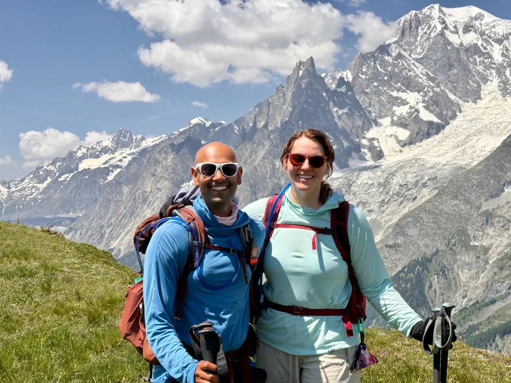
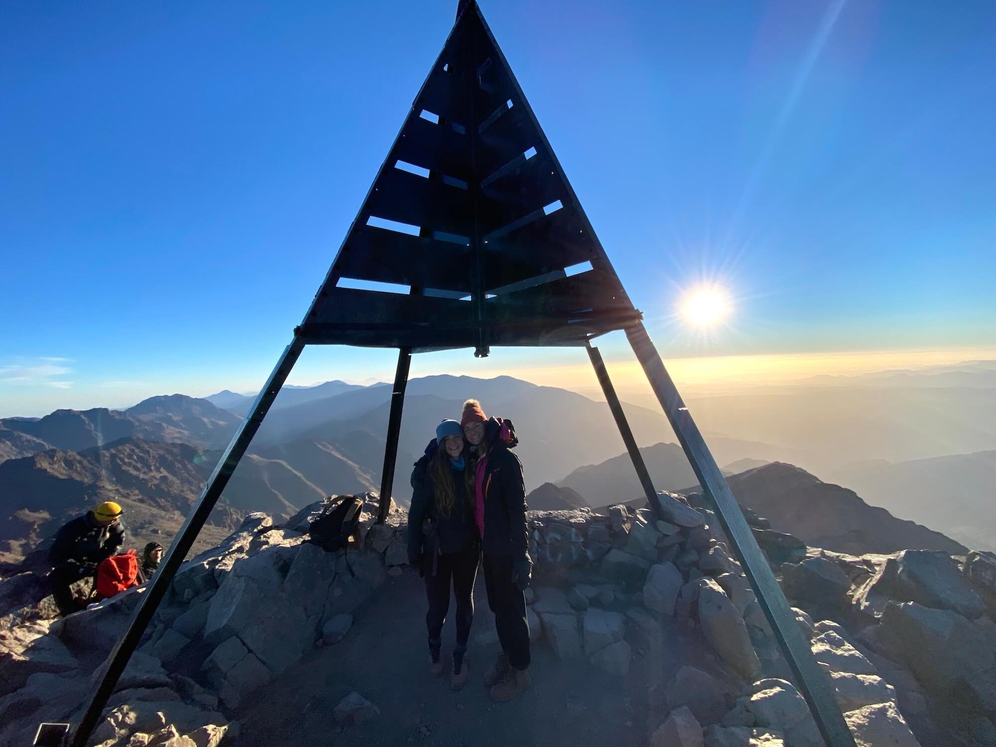
Learn how Michelle planned a last minute Tour du Mont Blanc trip for 2 people, staying in mountain huts and hotels.
While many of the wonderful Tour du Mont Blanc refuges will feature on your ideal self-guided hiking itinerary, what do you do if they have no availability when you go to book your own trip? In this blog post, I’m going to share accommodation booking tips and my top 4 booking tricks for finding accommodation that will keep your trip alive.
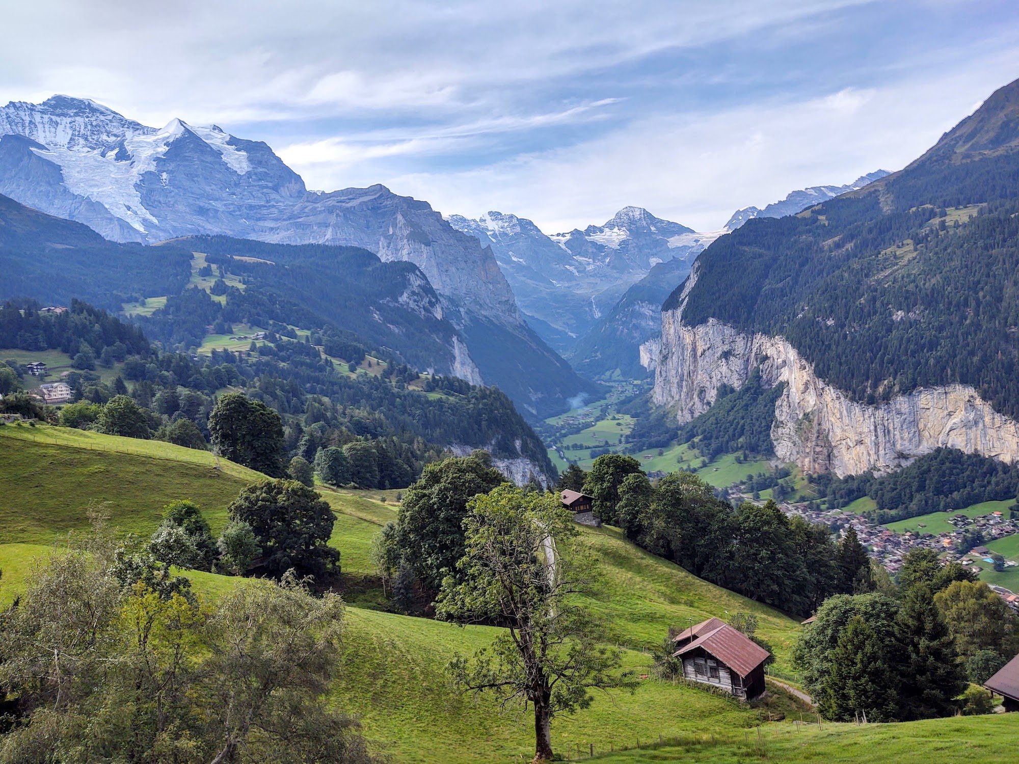
It costs 500 Swiss Francs to plan your own 6-day hike in Bernese Oberland, Switzerland.
This cost will vary depending on the number of days on the trail, and your accommodation, food, and transport preferences. So, how do you calculate how much it will cost for your trip? Here are a few sample itineraries using actual 2024 costs to help you out!
The Europaweg Trail between Grächen and Zermatt is one of the most famous two-day hikes in the Alps, as well as forming part of the Walker’s Haute Route and Tour of Monte Rosa. In the past few years, there has been some confusion about where exactly the Europaweg trail goes, due to the original route still appearing on some outdated maps, apps and guidebooks. In this updated post, I share details about the Europaweg trail, clarify where the route goes and share a brief history of trail changes in recent years.
It costs €826 to plan your own 10-day hike of the Tour du Mont Blanc. This amount comes from our new cost calculator for the Tour du Mont Blanc, which uses over 300 actual customer itineraries and 2023 costs from nearly 100 accommodation and service providers along the trail.
the calculator is for self-guided hikers to estimate how much it will cost them to organise their own hike of the Tour du Mont Blanc based on their preferences. Give it a try!
How much it costs to hike the Walker’s Haute Route is one of the most common questions I’m asked. Armed with my accounting background and mission to make every hikers self-guided dreams come true, I’ve dug deep into the numbers across all the different accommodation types, food and services available to provide firm guidance on what it costs to hike the Walker’s Haute Route.

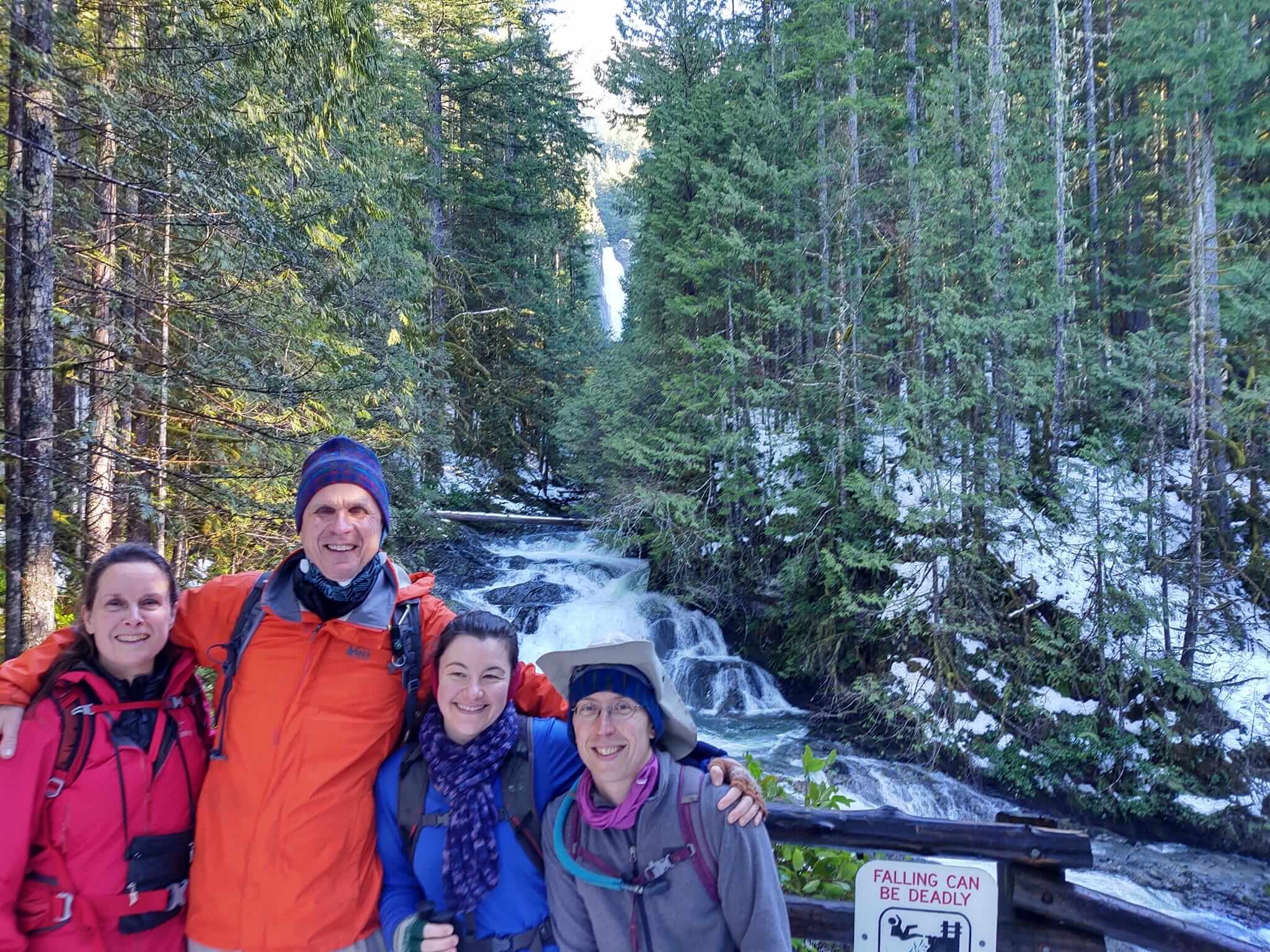
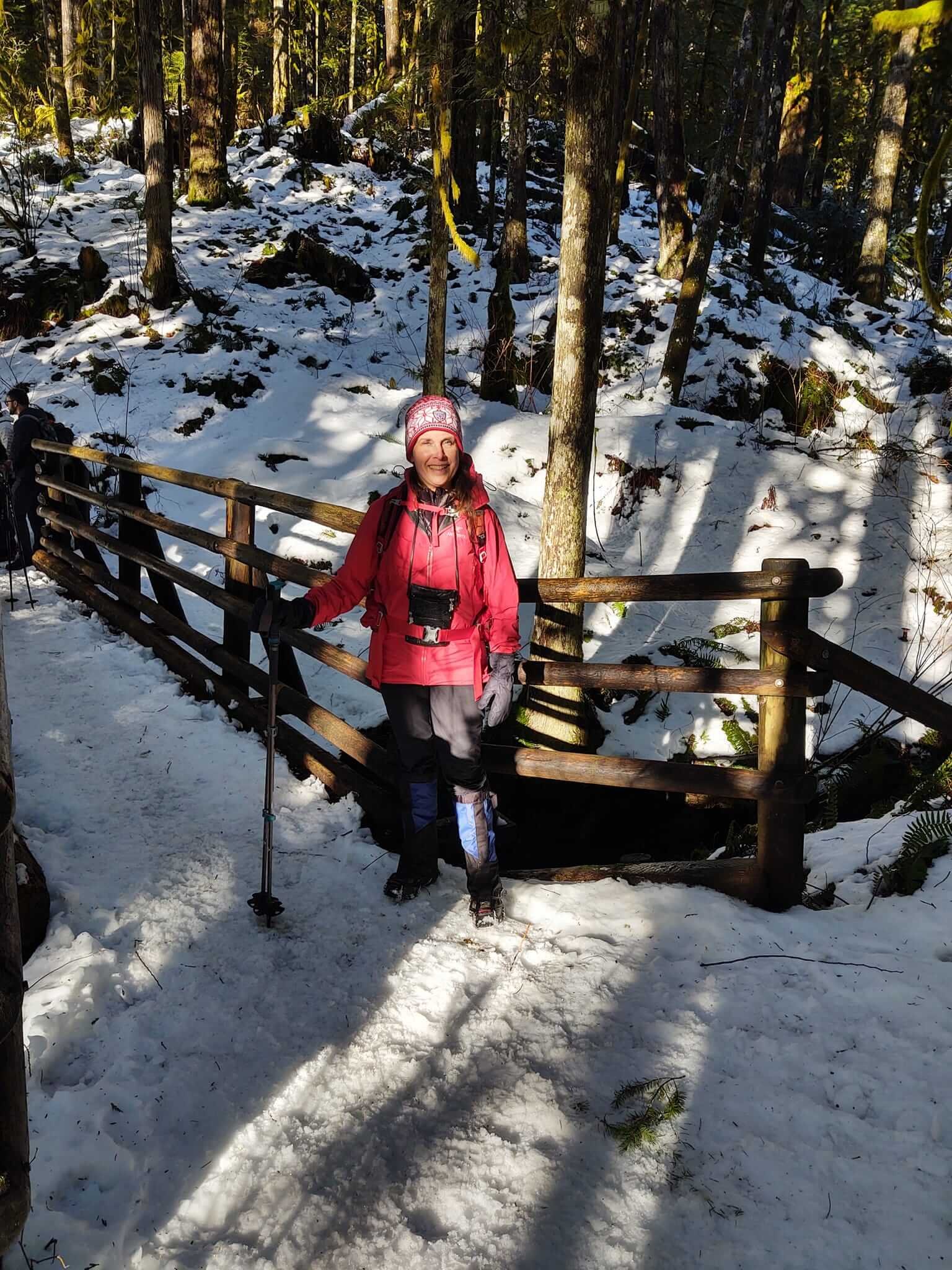
The Smith family hiked the full circuit of the Tour du Mont Blanc in July 2024, staying in gites, mountain huts, and hotels. They carried everything they needed on their backs (there was no luggage transfer). Read Meggan’s tips about preparing and hiking a multi-day hike with kids.
Attempting your first multi-day hike can be intimidating. Doing it with kids adds a layer of complexity. I hope in sharing our experience hiking the Tour du Mont Blanc with our kids (a 10-year-old son and a 12-year-old daughter) that you will have a better idea of what a trekking adventure in the mountains might entail for your family.

Of course, every child is different, and you know your child(ren) best. Our family was already fairly active, and most family vacations involved some physical activity, especially hiking when exploring the beautiful National Parks across the United States. However, none of us had completed a multi-day hike, and most of our hikes in the Eastern United States did not exceed 1,000 ft elevation gain, so hiking the Tour du Mont Blanc (TMB) in the Alps was going to stretch all of us physically and mentally. My kids are also good at following directions, so I felt reasonably confident that if we told them to “stop” on the trail, they would do so (we also practiced this on our training hikes).
Below are tips and lessons from our family’s experience preparing for and hiking the TMB with kids. I hope they are helpful to other families (or individuals) who are considering making the trek. It truly is a trip of a lifetime!

preparation is key
Although preparation is important for everyone planning to hike the TMB, we were especially intentional as we embarked on this adventure with our kids.
Practice hiking trails, increasing distance and difficulty over time. This seems obvious, but it’s so important to help kids get used to hiking on uneven terrain, not only to strengthen their muscles but also to learn how to navigate technical spots and build their confidence in covering longer distances.
Practice wearing your gear. Runners always say: “Nothing new on race day” and we adopted that same mindset for hiking the TMB. We practiced using ALL our gear from our socks and shoes and undergarments to our outer layers. Rainy day on the weekend? It's the perfect opportunity to test our rain gear and new waterproof socks. A dusting of snow? That sounds like a great opportunity to wear our nano puff jackets and work on our footing in slippery conditions. Sunny and warm? It's time to test our new sunshirts, hats, and sunscreen. Test EVERYTHING – especially on longer hikes. My daughter discovered that a shirt that was fine on short and mid-distance hikes ended up chaffing her on double-digit hikes. Thankfully we had time to find an alternative that worked before setting foot on the TMB.
Practice wearing your backpacks. Our family was hiking hut-to-hut with no luggage transfer, so we needed to get used to carrying our packs with EVERYTHING. We got fitted for our backpacks at our local REI (an outdoor recreation store in the United States) which helped us identify the right size pack that fit each of us. We started carrying the 10 essentials on our practice hikes; but as we purchased our gear for the trip, we progressively added it to our packs, so we got used to the weight. This also allowed us to figure out before we got on the plane what we truly NEEDED vs what we could leave behind to help shed weight.

4. Practice hiking on similar terrain. We did not have the luxury of traveling to real mountains with elevation gain comparable to what we would experience on the TMB, but we did our best to simulate the trek. We tried to find hilly trails near us, and once we got comfortable with double-digit hikes, we completed a few back-to-back hikes on the weekends. Over a 3-day weekend six weeks before our trip, we not only tackled three double-digit hikes in a row, but we also stayed at a hostel for hikers along the Appalachian Trail one of the nights to practice sleeping in an unfamiliar location after a long day of hiking. It was a fabulous experience and gave us more confidence that a multi-day hike was achievable and enjoyable.
5. Practice strengthening your mental game. We found that hard training hikes helped build resilience, and struggles along the way were opportunities to learn what helped our kids push on (we also figured out what did NOT motivate them... ahem, daddy lectures!). We quickly discovered that eating snacks early and often helped keep our kids cheerful and moving. If we waited until they got the hangries, it would take a while for them to recover. We also watched a lot of TMB videos on YouTube so they could see the big climbs and also get a feel for the types of places we would be staying on the trail. While they thought this was boring at the time, knowing what to expect seemed to help a lot once we were on the trail.

on the trail
Time to put all that preparation to use!
Take breaks. Prepare for lots of short breaks. Unless you have terrain and elevation gain similar to the Alps nearby, the TMB will probably still be challenging even with your training. Expect your kids to want/need lots of short breaks. These breaks are a great opportunity to make sure everyone is staying fueled and hydrated, adjust layers, and reapply sunscreen (side note: you’ll need more sunscreen than you might expect!) --- and provide the time to take breathtaking photos while you catch your breath.
Keep everyone fueled. Take advantage of the food on the trail. Have I mentioned that my kids do better when they have snacks? We usually opted to purchase two packed lunches from our accommodation (remember to order them the night before!) and we would either snack on them throughout the day or use them as our main mid-day meal (depending on what the food availability looked like for that section of the trail). This worked well especially when combining our packed picnics with short stops at refuges on the trail for additional food and drink (NOTE: I posted what we spent on the trail in my daily Instagram recaps to give an idea of cost). Another favorite thing we did was buy a baguette from the local boulangerie and tear off hunks of bread to nosh on while hiking.


3. Make adjustments as needed and as soon as identified. If a sock feels weird in your shoe, stop and fix it – don't wait until it becomes a bigger issue. Too warm? Stop and shed a layer. The time spent making adjustments to be as comfortable as possible is well worth it – especially if the change avoids blisters, heat exhaustion, sunburn, etc. Kids, or at least our kids, may recognize an issue but struggle with knowing how to make adjustments. Practice hikes can provide opportunities to learn how to adjust (especially your pack), but it is so important once you’re on the tail. Even small adjustments can make a day on the trail so much more enjoyable; for instance, our daughter quickly got into the habit of dipping a handkerchief in the cool streams that we crossed to cool off her face and neck.
4. Plan for distractions. While I wish I could say our kids were completely enthralled with the beautiful views of nature the entire time, the truth is, while yes – they had several moments of stopping to take pictures and marveling at the breathtaking landscapes – they also got bored. Our youngest found that he could deal with the hard climbs by having his dad tell him the storylines of various movies (one rainy day we were treated to a recap of the “Back to the Future” trilogy....). That did not work for our tween daughter, however. We figured out halfway through the trip that she was much more pleasant if she could listen to music on the hard climbs. Thankfully I brought my Shokz open-ear headphones. The complaining stopped if she could listen to music on the inclines. We let our son use them to listen to an audiobook during the long descent to Les Houches on our final day, and it added a pep to his step. For our next multi-day trek, I will probably make sure we have two sets of Shokz (I like them because they are open-ear, so you can listen to your audio while still hearing those around you – an important safety measure!) with audiobooks and music pre-downloaded to our devices.

5. Take note of shortcuts. While we only made use of a few of the shortcuts available, I did take note of the various public transportation, cable cars, and shortcuts ahead of time, so if we had bad weather, were short on time, or someone wasn’t feeling well, we had options. We planned to take the Bellevue Cable Car on the first day and were happy we did so – especially since we did the Col de Tricot variant. Taking the Delone Cable Car was a huge plus for my daughter as we headed down to Courmayeur for a rest day. I will say that this is where customized maps from The Hiking Club combined with the Organic Maps app were super useful – you can see public transportation options – but also alternative routes. On our last two days on the trail, less-than-ideal weather had us adjusting our routes on the fly, and I was so thankful that we could see what options were available to us when we needed to make decisions in the moment.
6. Staying in accommodations. We were fortunate enough to book private rooms or 4-person dorms for all nights except two on the trail. This worked well for our family, as it allowed the kids to be a little more comfortable after a long day of hiking. We still got the mountain hut experience with the shared meals and (often) shared restrooms. Our two evenings in shared dorm rooms were fine – thankfully we had lovely roommates both times (6-person dorm rooms). But the nice thing about hut-to-hut hiking is that even if you don’t love the place you’re staying at one evening, it is only for one night and you’ll have a new place to look forward to the next night.


While hiking the TMB is not for everyone, with the proper preparation and a willing attitude, it is possible to complete the trek (or part of the trail) with children. I loved watching my kids grow on the trail. They adapted to trail conditions, problem-solved, tried new food, and met people from all over the world – all while hiking more than 100 miles over 11 days. Was there complaining? Yes. Were there tears? Yes. Were there sore legs? Yes. But there were also memories made, relationships formed, and fears conquered – it was the trip of a lifetime. All of us learned to be more resilient; we pushed through pain and fatigue and learned each day that we could do hard things.
Upon returning home, we returned to our familiar trails of the AT and started reminiscing about the Alps... My teen daughter started talking about which sections of the TMB she would want to repeat when we return in a few years – as well as what other trails she would like to explore in the Alps.
Time to start planning our next adventure!
Follow Meggan on her Instagram for more family hiking content: @mountainsarecalling_wemustgo
Sam McGrady and Steve Smedley live in Matlock, Derbyshire, and are seasoned multi-day trekkers across Europe and the UK. Focused on travelling as light as possible (no camping), they undertake at least one long-ish trek each summer using mountain huts and small villages for accommodation. Previous trips have included Walkers’ Haute Route, GR11 (Spanish Pyrenees traverse), Tour de Mont Blanc, Tour de Monte Rosa and AV1 (Dolomites).

Summer 2024’s adventure took Sam and Steve back to Switzerland to undertake the Tour of Jungfrau Region (JFR) – which whilst following the ‘official’ route most of the time, they made their own with variants, side trips and some extra days thrown in. It should also be noted that Sam and Steve are vegetarians, so references to food should be taken in that context and explains the obsession with rostis on this trip!
13 hiking days
1 rest day (at Kleine Scheidegg)
Total distance – approximately 196 km (122 miles)
Total ascent/descent – 12,390m (40,650 ft) gain/loss
Start/finish – Wilderswil (Interlaken), Switzerland
It’s very popular and busy – not so much the trail itself but there are lots of very accessible points most days via an excellent integrated public transport system (trains, cable cars, ski lifts, buses) resulting in hoards of ‘tourists’. It’s not a trek for getting away from it all.
The walking is straight forward, nothing technical. Likewise route finding simply isn’t an issue. The amount and variety of accommodation options mean you can make your days as long or short as you want. Don’t feel the need to stick to the traditional route and stages, busk around the template.
It is an area of outstanding and amazing scenery – Eiger, Monch and Jungfrau are omnipresent and undoubtedly the star attraction, but this should not diminish the contribution of many other outstanding mountains that will be familiar to alpinists but not the average hiker or tourist. There are also numerous glaciers to see and the landscape is varied and interesting. When we went the alpine flowers were abundant and a joy to see. Take your time, stop and stare.
Having flown to Geneva and then taken a train to Interlaken the previous day, we started our TJR with a great breakfast in the Alphorn hotel in Interlaken, including fresh fruit and hard boiled eggs. We walked across the Ruegen to Wilderswil (a lovely village in contrast to the somewhat tourist-hammered Interlaken) then set off walking uphill through forest to the cog railway station at Breitlauenen, which has a fab little café.
As the onward path to Schynige Platte was closed due to rockfall we took the cog railway for the remaining relatively short distance – which was fun! After checking in to the somewhat swanky Berghotel Schynige Platte (the only show in town) the cloud was down and the rain had started. As we’d reached our destination for the day this wasn’t a problem and we had a decent meal in the hotel looking out at cloud and rain where one of the best views in Switzerland should have been!

Panorama Schynige Platte to Grosse Scheidegg
We woke up to completely clear skies, sun and amazing views of the full mountain range opposite – Eiger, Monch and Jungfrau, which would accompany us on much of this trek. After a great breakfast of eggs, cheese and local honeycomb, we packed up and set off, taking our time for the first few miles to stare and take photos.
Spring flowers were abundant. The weather was sunny but with a fresh cool wind. The route took us across myriad snowfields which really slowed us down. However, we had absolutely amazing views all the way – Eiger, Monch and Jungfrau to the right and Brienzsee below us to the left - and even saw an eagle near the Faulhorn (today’s high point).

Views all the way – Eiger, Monch and Jungfrau
The route wasn’t too busy until we reached the Bachsee lakes, which were teeming with visitors who had come up on the gondola to First. We were happy to leave the selfie-fest behind at First (the official end of today’s stage but not our end point) and took a solitary walk to Grosse Scheidegg in increasing cloud. What an amazing spot - right underneath the Wetterhorn.
Again, the Berghotel Grosse Scheidegg is the only accommodation here, and we had a cosy double room. The food was good: salad plus rosti with fried vegetables. After a long day we headed for an early night.

Wetterhorn above Grosse Scheidegg
After a fairly basic breakfast, we headed off around 9.30am down the path towards Grindelwald. After about 30 minutes we went left on a TJR variant towards the Gleckstein Hut. The route comprised a somewhat vertiginous path a lot of the way with chains and cables – but all perfectly manageable. Up, up and up we went. Above us towered the Oberer Grindelwald Gletscher and beyond it the Schreckhorn; we also saw chamois, ravens and choughs.

View of glacier from Gleckstein Hut
All day we had full, hot sun, because whilst the substantive route is roughly east/west, the variant to the hut is north/south. The hut was in an amazing spot, and we drank coffee whilst watching ice falls from glacier – we could have stayed all afternoon!
After a slice of delicious nusskuchen, we headed back down the same way we came, which was hard on ageing knees and our walking poles were required. We stopped for a snack at possibly the most exposed bench in the valley before re-crossing a short snowfield then heading across meadows to Hotel Wetterhorn near Grindelwald.
We sat outside with a beer and looked up at the knife edge Mittellegi ridge of the Eiger right above us. Our evening meal comprised another rosti (this time with egg and cheese) and a savoury vegetable strudel. A wonderful spot to end the day.

Most exposed bench in Grindelwald valley!
After a decent breakfast of fresh fruit and muesli, we set off around 9am in the dry, although rain was forecast for later in the day. As it happened we spent most of the day in woods but we did get some short lived heavy rain in the afternoon, necessitating an outing of our waterproof ponchos!
Again, we decided to make a side trip off the TJR up and back to Berggasthaus Barregg to see another glacier – not such a big climb but an equally great spot where we had coffee, and a good chat with the hut guardian about how the previous month’s awful wet weather had taken a real toll on trade.
After a long descent back to the valley bottom, we climbed up all afternoon, eventually making it to Alpiglen. The route was excellent, right underneath the Eiger and we saw several chamois. Unfortunately the cloud was down most of the time so we couldn’t make the most of the location. However, on the short descent to Alpiglen itself the cloud broke up enough for us to have views right across the valley back to Schynige Platte. Once again we were in the only available accommodation in the hamlet.
In the evening we got chatting to some young American hikers who were doing some of the TJR but in the opposite direction; for a future trip they usefully put us onto the White Mountains in New Hampshire where they have a hut system similar to Europe.

Snowfield and sheep on way to Alpiglen
Hotel Alpiglen provided a good breakfast with fruit, yogurt, muesli, bread and cheese; we strung it out due to 100% cloud cover and light rain, and so didn’t leave till gone 10am. Climbing up we crossed numerous torrents and small snow fields, and saw two alpine salamanders which seemed unaware of Darwinian evolutionary theory and slowly meandered around our feet.
The cloud lifted a little from time to time but it was very frustrating that we were right underneath the Eiger north wall and couldn’t see it! The rain stopped around midday but we were still plagued with poor visibility. We stopped at Eigergletscher (gondola and train station) for coffee and Rahmschnitte cake (a local speciality, great for morale but bad for the abs!).
From here it was an easy half hour down to Kleine Scheidegg, conditions were cool and cloudy. After checking into our accommodation at Restaurant Grindelwaldblick we did some laundry and booked tickets for the Jungfraujoch for tomorrow – our first rest day. The cloud was still down so we had yet to see the infamous Eiger North Face properly. To celebrate making it this far we ordered a cheese fondue which was delicious! It is worth noting that when the cloud clears, this location has one of the best views of Eiger, Monch and Jungfrau due it standing half a kilometre or so back from Kleine Scheidegg itself.

Eiger North Face emerges from cloud
We got up at 7am to try to get the early bird train to Jungfraujoch (the amazing railway which goes through the middle of the Eiger and pops out at the saddle between Monch and Jungfrau, where there is a huge visitor centre). There was an enormous number of tourists, and we had to queue and so didn’t get the first train; it’s definitely worth paying the extra to reserve a seat in advance. In fact the whole thing was unbelievably busy all day. However, it was an exciting train journey up through the tunnel, and we headed straight out into the snow and walked to the Monchsjochhutte for coffee and plum tart. This was our only use of our micro spikes on the whole trip.
After a quick look round the tourist attractions at the centre (not really our thing), we took the train down to Eigergletscher and then walked back along part of yesterday’s route to the foot of the Eiger which came out of the cloud at last, and we were delighted to spot the train Eigerwand windows. After an afternoon’s rest we ate at our hotel again then went outside to stare at the Eigernordwand.
Between Jungfraujoch and Monchsjochhutte
After our day off (in which we still did two short walks!), this was a long day and our feet felt a bit pounded by the end, not least because it was very hot all day. The route took us down what became quite a tough descent close to the foot of the Jungfrau with excellent views of its pyramidal sub-peak, the Silberhorn, to the Trummelbach Falls, followed by a few welcome flat kilometers along the valley bottom to Stechelberg. Officially, this day’s stage ends here, but we had been unable to book accommodation at either of the two berghotels in the village, and so we ended the afternoon with a hot ascent to Murren (and as a result were once again ‘off’ the official TJR route). No-one else was ascending – they had all gone up in the gondola and were sauntering back down!
Today took us from the Grindelwald into the Lauterbrunnen valley, which was interesting in itself, and we also noted this was the lowest altitude we’d been at for a week; it felt different and gave us a better sense of just how high the mountains here are, as we were so far below them. After a welcome shower at our hotel (Hotel Jungfrau Murren) and a beer, we ate another rosti at Hotel Alpina which had amazing views across the valley.

Lauterbrunnen valley looking towards Breithorn and Tschingelhorn
Murren was noticeably quieter this morning, the gondola and train having yet to start running! After another lovely Swiss breakfast of scrambled egg, cheese, fresh fruit and seeded bread, we set off down to Gimmelwald via the Co-op (to stock up on peanuts and dried apricots), one of the few shops on our trek. We were heading back onto the official TJR route, but doing this and the next stage in the opposite direction due to our starting and end points. We headed down to Im Tal, crossed the river then walked steeply uphill in woodland for over two hours to Tanzbodeli, a flower-filled plateau.
After early light rain showers the cloud lifted and the sun came out. We descended from the plateau and contoured to Obersteinberg for a beer. Not much fancying a night of cold showers and no electricity (apparently these are ‘attractions’ of Berggasthaus Obersteinberg!), we headed 15 minutes down the valley to Berggasthaus Tschingelhorn, where we had a lovely wooden room with a balcony and chairs. We took advantage of a shorter day and rested our tired legs, planning our onward route as our plans to get up to the Schilthorn were well and truly scotched by a combination of not being able to get a bed at the Rostock Hut along with rain and low cloud forecast.
We have a rule about not going up a mountain for the sake of ticking it off: what is the point of doing it if you can’t see anything, particularly if the weather is going to be miserable. The evening meal was tasty (Thai soup, falafels and pasta) which we ate watching goats play outside.

On the Tanzbodeli
Today was a great route, taking us high up into the Oberhornsee hanging valley, though it felt like a longer day than it was! An easy longish ascent brought us to the small lake: Oberhornsee, which was beautiful and we spent a long time looking at the mountains being reflected in it and taking photos.
There were a few people on the trail but not many; much of today felt more remote than some of the other stages due to the lack of transport to bring tourists up here, to what is effectively the head of the Lauterbrunnen valley. After a short out and back to the Schmadri Hut (unmanned – we just went for the extra ascent!), we headed down some tricky terrain which slowed us down, along with hot and humid weather. We stopped for a refreshing cold drink and apricot tart at Trachsellauenen.
Our accommodation at the Mountain Hostel at Gimmelwald required yet another ascent at the end of the day, and we were pleased to have a beer and a surprisingly tasty pizza here. At one point the heavens opened and some very heavy rain came down. We slept well despite it being a hostel full of what seemed to us very young people!

Reflections in the Oberhornsee
As above, weather and accommodation options put paid to us sticking to the TJR (which would have taken us up and over the Schilthorn) for the next few days, so we made up our own trek. Today we woke to overcast skies with heavy rain forecast, requiring a very short day. We embarked on a local route called the North Face Trail (nothing to do with the clothing brand!) which zigzagged above Gimmelwald and Murren and had information boards at regular points explaining ascents of the north faces of all the mountains opposite us.
Despite the cloudy day, it was (at this point) high cloud and gave us the best views so far of the high peaks opposite. We kept looking up at the Schilthorn above us and were tempted to give it a go, but stuck to our plans and headed straight to the Blumental and Pension Suppenalp. After some lunch we left our rucksacks and took a stroll over to the gondola station at Allmenhubel, but rain and cool winds drove us back; the cloud was down and we were satisfied with our decision not to attempt the Schilthorn in what would have been challenging conditions with no view. Sometimes the weather wins, At least we have an excuse to go back!

In the mist at Allmendhubel
Today we were headed to Wengen where we’d decided to spend three nights so as to extend the TJR, to see some of the local walks not on the official route, and to cook our own veggie food. Our only objective was to reach Wengen. We headed off into low cloud and drizzle again, and saw only a few other walkers. Towards Grutschalp we took a continuation of the North Face trail which is effectively a balcony route high on the west side of the valley. We extended our walk beyond Grutschalp in the hope of better weather coming in, but as this didn’t happen we had a coffee at the gondola station and walked down to Lauterbrunnen.
The town was very busy so we didn’t linger and headed straight up to Wengen, a lovely village which seemed to be very busy at weekends but much quieter in the week. After checking into our self-catering somewhat bijou studio, we found a launderette and supermarket, then cooked bean, lentil and vegetable stew which we ate for the next three days – we needed a break from cheese and potatoes! The cloud stayed down all evening and it was noticeably cooler.

Looking down at Lauterbrunnen
Our first full day in Wengen turned out to be one of the best days on the whole TJR (even though it’s not on the TJR!), as the views from Mannlichen were amazing! From the top we could see the whole TJR route - both valleys and all the mountains. We were surprised that Mannlichen is only included as an optional side trip from Kleine Scheidegg on the official tour.
We took a very steep ascent up the Gemsweg (path of the chamois) to the gondola station just below the summit on what turned out to be a gorgeous sunny day with full visibility - apart from cloud stubbornly hanging on the Schilthorn! The summit was heaving with tourists, so after marvelling at the panoramic views of the TJR, we pressed on towards Kleine Scheidegg on a contouring route which was quite busy.
Before reaching the village, we headed up onto a higher contour around the summit of the Lauberhorn which was much quieter. The descent down a ski piste towards the Lauterbrunnen/Kleine Scheidegg railway line was steady but tough on the legs as it was sustained and lengthy. We stopped around 30 minutes short of Wengen at Allmend for a beer then headed back to Wengen, where we ate on our balcony looking at the outstanding view up to the Breithorn.

Panorama Grindelwald valley from Mannlichen
Having decided to treat today as a short/rest day, we did a local walk in lovely sunshine which took us up and along to Spatenenalp then back via the Leiterhorn viewpoint. This was useful as it gave us a good insight into tomorrow’s route (back up to Grutschalp, along and down to Wilderswil). The rest of the day comprised reading on the balcony, a short walk around the village, and culminated in a massive electric thunderstorm which we watched from the balcony around 7pm.

View from Spatenalp
Our last day! Fortunately the weather was much better than anticipated but everything was very wet underfoot after last night’s rain. Most paths were mud or streams or super slippy wet limestone and tree roots. We walked down to Lauterbrunnen and decided to cut out around 1.5 hours of ascent (which we’d already done in the other direction) back up to Grutschalp by taking the gondola. From there, it was a really nice route contouring through trees which then opened up eventually to the Lobhorn Hut; we ate our lunch by the little lake there.
Onwards there was a little more ascent to cross a very stony corrie, the Tolkienesque Sylertal, where we followed a solitary chamois along the path. We finally began the long descent through woods all the way down to Wilderswil. Here we took the most direct route back to the village which zigzags north past the Schwarzhore rather than the official route via Saxeten. It was somewhat knee jarring and a bit mind bending – a good mental test! However, with hindsight we should have stuck to the suggested route as it probably offered a gentler and more interesting descent than the steep woods!
Towards the end we stopped at a memorial for 1998 flash flood disaster victims, which was sobering. After arriving at our final hotel (Hotel Edelweiss), a shower then a beer plus another fondue concluded our trek. Our legs were tired but as ever we were pleased we completed it and ready to eat anything but cheese!

Lunch spot on last day
Additional notes:
A note about the Eiger North Face and the train – the train passes the window in the north face where rescuers got tantalisingly close to rescuing poor Toni Kurz in 1936. Only 23 years old, he died just feet away from them, unable to abseil past a knot in his rope. The excellent documentary that tells Toni’s story (“The Beckoning Silence”) is essential preparation for staring in awe at the North Face and a sombre antidote to the ‘theme park’ at the Jungfraujoch.
To help understand the lay of the land, think of the TJR as being scruffily hung around a letter L which has rotated 90 degrees clockwise. West/east is the Grindelwald valley, south/north the Lauterbrunnen valley. The route in effect follows the skyline of these two. Mannlichen sits at the apex. It is almost too much to take in – which is why the TJR is so different from most linear long distance routes. Here, at Mannlichen, your entire trip is set out as a wonderful 360 degree panorama.
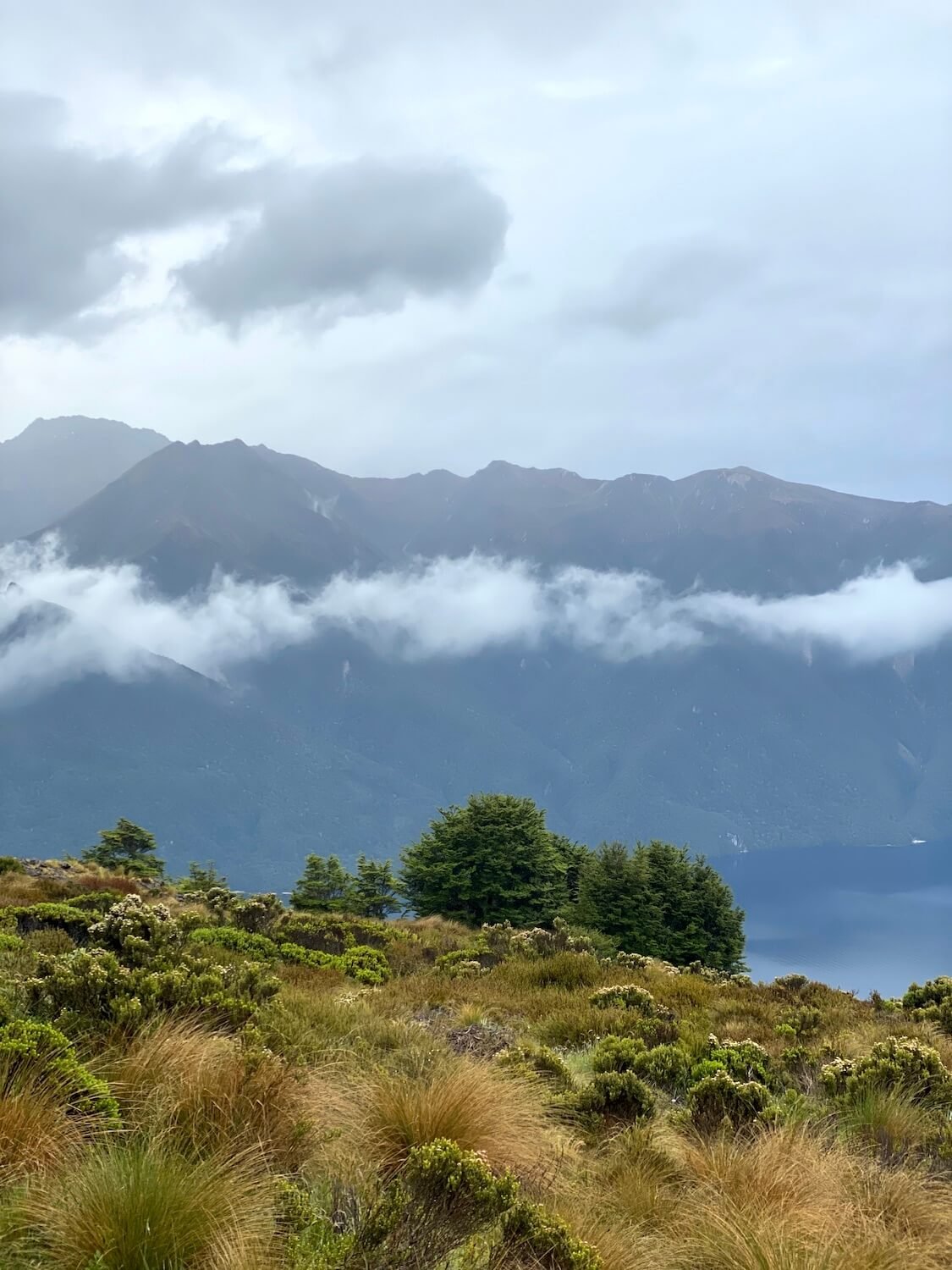
The Bear Trek is located in the Bernese Oberland, Switzerland and is part of the Via Alpina 1 hike that includes 20 stages from Lichtenstein and continues to Montreux, Switzerland. Read Cindy and Bob’s trip report documenting stages 10 - 15 from Meiringen to Lenk, Switzerland. Spoiler: No bears were seen on this hike!
The Montafon Hüttenrunde (Hut Circuit) is a multi-day hiking trail located in western Austria. Read Julie’s trip report for their 11 day hike starting in Bartholomäberg and ending in Latschau, Austria, staying in mountain huts along the way. They hiked 141km, climbed 7,500m in elevation and reached Seelucke at 2,744m. The trail travelled through the heart of the three very different mountain ranges that frame the Montafon Valley - the moody highland heaths and silent peaks of the Verwall, the sharp dark teeth and looming glaciers of the Silvretta, and the sheer white cliffs of the Rätikon.
Are you thinking of hiking in the Alps with kids? Read Sara’s story of taking her son to the Alps to complete the Tour du Mont Blanc at the age of 8 and the Walker’s Haute Route at the age of 11. Was it easy going? Not all the time. But the encouragement from others on the trail kept him going, as well as their promise to take him to Disneyland Paris when he was finished. Yes, sometimes a bit of bribery is needed!
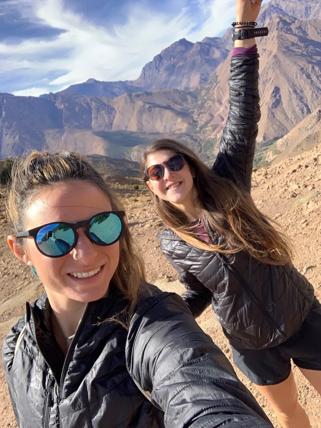
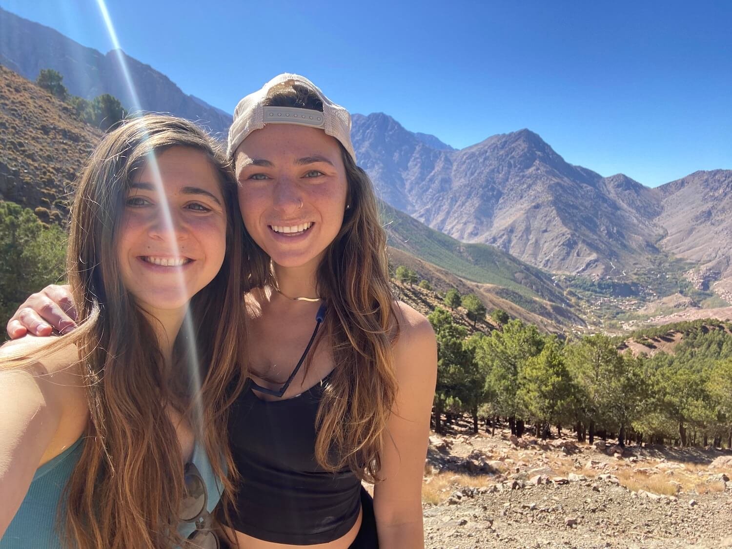
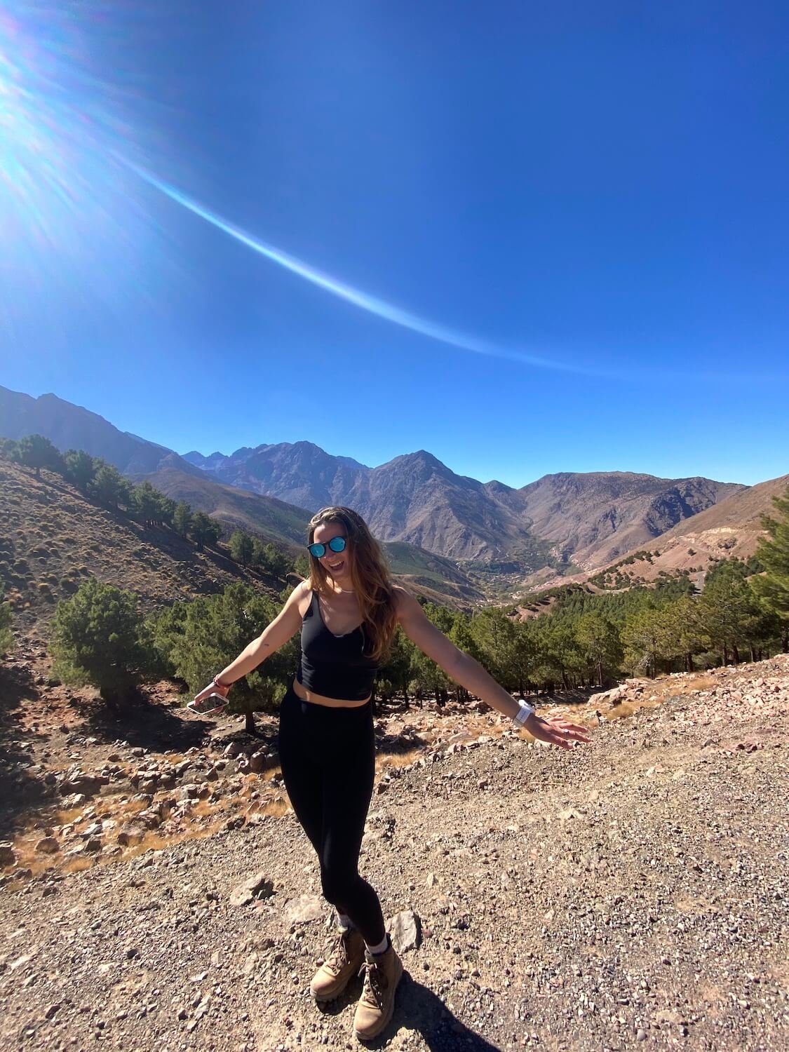
Kayla Costigan is an American travel nurse I met while I was trekking solo in New Zealand. We connected over a shared passion for travel, nature, movement, and helping others. We have since hiked together throughout the United States, as well as in Morocco, Portugal, and Prague. I asked Kayla some questions about what hiking means to her. This is her story…
As a kid, my parents would have to drag me to go hiking. We would go to New Hampshire from our small Boston suburb and hike for one to two hours. I remember trying to beat my sister to the top, eating Clif Bars, and only pausing for one minute before running back down.
I then hiked a few times as a young adult. Once, when planning a trip in Colorado with my sister, I remember thinking, ‘these reviews on AllTrails are not right. I could push myself to more advanced hikes and higher peaks’. As sports slowly exited my life and physical feats were harder to come by, I began turning to other things to feel accomplished and focus on, and hiking filled that void.
In early 2020, I was planning a solo trip to New Zealand and Australia for two months. The perk of traveling solo was that I could plan the trip that I wanted. I searched online for the best hikes in New Zealand and learned about the Great Walks. I was hooked. My first choice was the popular Milford Sound Track, but it was sold out for my dates. The second was the Kepler Track. The hike was for four days and three nights. Woah, overnight hiking? I hadn’t done anything like that before. I wondered what it would entail? Would I sleep in a tent? What gear would I need to bring?
I signed up for the trek on Christmas eve, as my family watched Harry Potter next to me, complaining about the light from my laptop. I smiled to myself as I closed my computer after reading the confirmation email. I was ready to take my hiking to the next level. I would be doing the Kepler Track.
Kepler Track, New Zealand. Jan/Feb 2020. Photo: Sam Goldklang.
I learned that I was not sleeping in a tent but in hiker huts tucked into the mountains. I had never done anything like this. I made it to the start of the trek after countless Google searches for flights, buses, and hostels in these ‘Southern Alps’.
The day was finally here. With my bag packed, I stood at the permit office in New Zealand. “You should not do the trek!” the woman at the desk said as she judged the abnormally small size of my pack. “The forecast is for inclement weather, the most rain New Zealand has seen in 100 years. There is a risk of mud-slides”. I had traveled so far to do this hike and had my heart set on it. I had been running every day to train for it. I needed it.
I thought to myself, ‘okay, I will go to the first hut, if I feel unsafe, then I just turn around and hike out, as simple as that.’ I felt prepared with enough food and water to last me a few days and I had plenty of layers to keep warm.
First hut on the Kepler Track, New Zealand. Jan/Feb 2020. Photo: Sam Goldklang.
Kepler Track, New Zealand. Jan/Feb 2020. Photo: Sam Goldklang.
I followed my gut, the same one I have learned to listen to and trust. I entered the trail alone with hours and miles of hiking ahead of me. I can do this, I know I can. I watched my cell phone service bars dwindle with the sunlight. The clouds were upon me but I kept moving forward. I realized that I had never been alone in the mountains before, let alone mountains on the southern island of New Zealand. It was gorgeous.
I started seeing glimpses of giant fjords through the clouds, proof of my elevation gain and an inspiration to fuel those endorphins and tolerate the raindrops beginning to fall from the sky.
For one of the first times in my life I felt peace and was comforted by the silence and solitude. I was no longer afraid but energized, walking step by step toward my goal, and knowing that I had got myself to this moment. I felt a sense of calm that would help shape many future decisions. Instead of only chasing the highs, the excitement, and the peaks, I started seeking out quiet sacred moments with my best friend: myself.
Kepler Track, New Zealand. Jan/Feb 2020. Photo: Sam Goldklang.
Throughout the trek, I was sometimes alone, but at other times I connected with hikers on similar, parallel journeys who, like me, appreciate the power of nature and the peace it provides. Yes, I did make it to the first hut that day! After four 4 days of walking, I completed the Kepler Track; hiking through record rainfall, finding direction through nature, both presently and for my future, and connecting with new friends along the way.
At that first hut, I met Sam, a hiker from Seattle who was also trekking and traveling solo, seeking peace and connection with nature to help her along her personal journey. People you meet on the trail are special and they stick with you. You create a bond that is unique to the disconnection from the rest of the world, something that is hard to come by in our connected world. The trail provides this space.
Since meeting in that hut in New Zealand, Sam and I have hiked in 4 additional countries, completing a road trip through the National Parks of Utah, USA, on a guided trek through the Atlas Mountains in Morocco to the second highest peak in Africa, up the coast of Portugal on The Fisherman’s Trail, and on a day hike outside of Prague.
Sam Goldklang and Kayla Costigan on the Kepler Track, New Zealand. Jan/Feb 2020. Photo: Sam Goldklang.
Any conversation on a trail is pure, whether it is with other hikers or with yourself. It is my favorite place to get quiet and tune into my gut. Hiking is where I am the most present and able to fully listen with the intent to learn and share my own wisdom and experience in return. The presence that I found on the trail is something I now try to bring into the rest of my life.
I now seek out other ways to shut down my mind without needing a flight across the world or an epic adventure. These are things I can bring into my everyday life. I fell in love with meditation and recently became a certified meditation teacher. I find quiet moments in my days to be still, feel present, and take it all in. I practice yoga, find nature wherever I can, go for walks or runs wherever I am, and drag friends and family to appreciate the power that the quiet of nature provides.
The Kepler Track changed what it is I seek out in life. It made me crave peace, a type of peace that is easily found in nature, and it brought amazing people into my life. It helped me begin to explore the body mind connection and the power that exists between the two.
Hiking is a form of moving meditation to me, and whether alone or with others, it is the time I use to check in with myself and where I am in life and on my journey. It is a time where I find a sense of stillness in motion and that in turn brings me peace.
Hut on the Kepler Track, New Zealand. Jan/Feb 2020. Photo: Sam Goldklang.
Kepler Track, New Zealand. Jan/Feb 2020. Photo: Sam Goldklang.
Kepler Track, New Zealand. Jan/Feb 2020. Photo: Sam Goldklang.
Kayla Costigan on the Kepler Track, New Zealand. Jan/Feb 2020. Photo: Sam Goldklang.
Sam and Kayla on the Fisherman’s Trail, Portugal. Photo: Sam Goldklang.
Fisherman’s Trail, Portugal.
Kayla and Sam on the high Atlas mountains, Morocco.
Sam and Kayla trekking in the Altas Mountains of Morocco. Photo: Sam Goldklang.
Kayla in the Atlas Mountains, Morocco. Photo: Sam Goldklang.
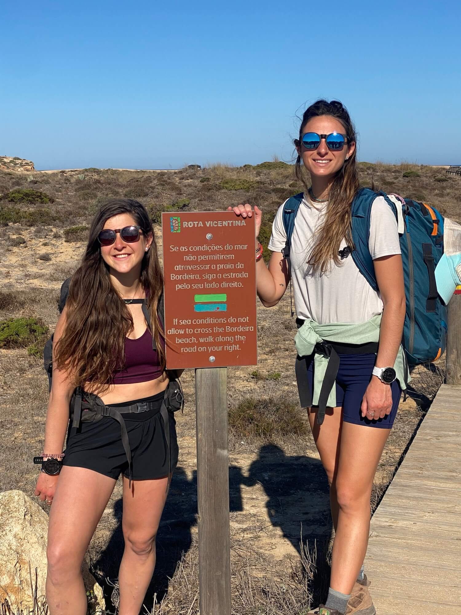
The start of the Fisherman’s Trail, Portugal. Photo: Sam Goldklang.
Sam and Kayla on the summit of Mount Toubkal, the highest peak in the Atlas Mountains, Morocco. 13,665 feet / 4,165 metres. Photo: Sam Goldklang.

Author: Sam Goldklang, USA
Sam is an everyday adventurer who resides in Washington State, USA. She has completed the Wonderland trail and summited the 5 tallest peaks in the lower 48 states, including Mt Rainier. Sam has hiked around the world with some of her notable trails being: the Tour Du Mont Blanc in the Alps, The Kepler and Routeburn tracks in New Zealand, the Salkantay Trek in Peru, the Mt Toubkal trek through the Atlas Mountains in Morocco, The Fisherman's trail in Portugal, and Trolltunga in Norway. Sam spends her days working as a Pediatric Nurse Practitioner and on the weekends she'll be hiking, camping, trail running, backpacking, or skiing around the Pacific Northwest.
Follow her adventures on instagram: @sgoldk
The Hiking Club empowers anyone to walk the way they want in the wild with personalised self-guided hiking experiences that are easy to find, quick to plan and simple to navigate.
We believe hiking experiences have the power to transform lives. With a growing range of personalised hikes that take into account your preferences, fitness and interests, we give you everything you need to explore the legendary trails of the world!
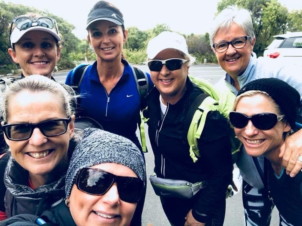
Community Leader Spotlight: Di, Liz and The Adventure Angels hiking group
on the Sunshine Coast, Australia.
In 2015, while in recovery from breast cancer, Di Olson pledged to walk 5 days along The Great Wall of China to raise funds for cancer research. “I’ll do it with you!” was the instant commitment from her best friend Liz Ward. Little did they know, this hike would spark a love of hiking for more than just the two of them.
Di and Liz and The Adventure Angels on a sunrise training hike on the Sunshine Coast, Australia.
New to hiking, Di and Liz were aware of the challenges of the 5 day hike they had planned nearly 12 months away. With difficult access to parts of the trail, some less well-maintained sections, and heights up to 3250 m (10,662 ft), both knew they would be disappointed if their physical fitness let them down. So they began scheduling regular training hikes in their local areas on the Sunshine Coast in Queensland, Australia. Before long, a group of friends and acquaintances were joining them on sunrise hikes up Mt Ninderry, Ngungun and Mt Coolum.
After months of religiously meeting at 5am for a hike, several times a week, a core group of women had become close friends. “Acceptance, tolerance and camaraderie became what our group was about,” Di recalls the atmosphere of those training hikes in the early days of The Adventure Angels.
The group is made up of women between the ages of 47 and 67 who are also business owners, parents and professionals from a variety of backgrounds. Like Di, some of the women are also cancer survivors.
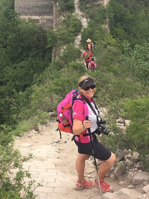
Di Olson climbing the Great Wall of China.
In the lead up to The Great Wall of China hike, not only did they become fitter and stronger, but almost everything in their lives soon revolved around hiking and hiking equipment. They laugh about becoming complete gear nerds and their long conversations about the virtues of walker’s wool for blister protection.
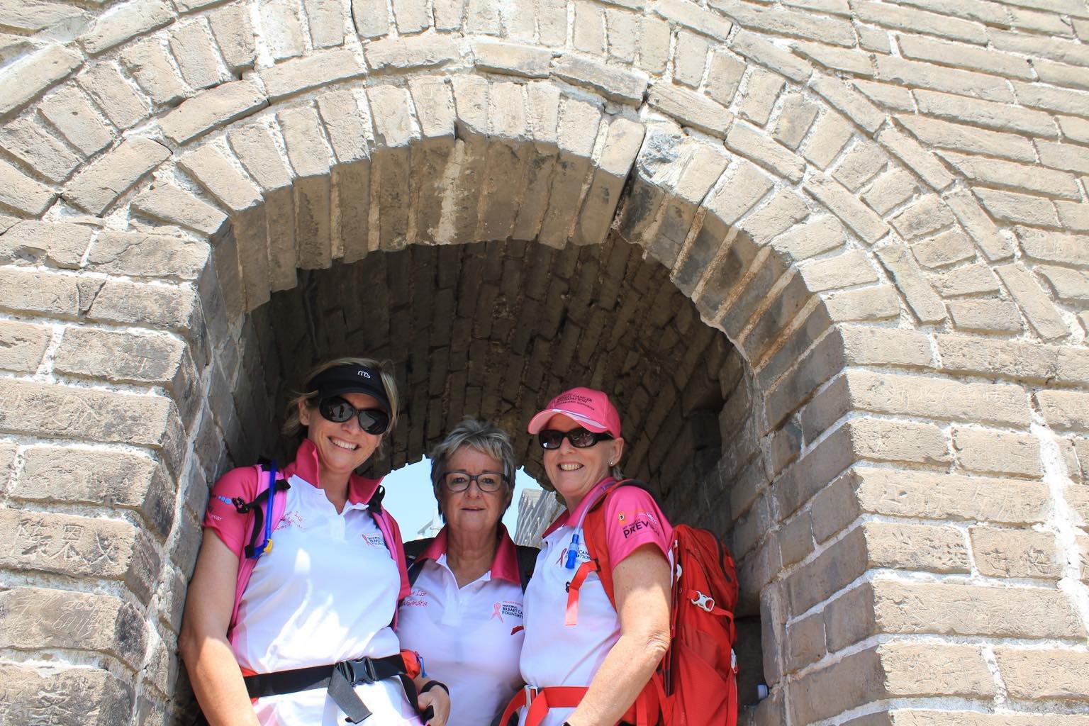
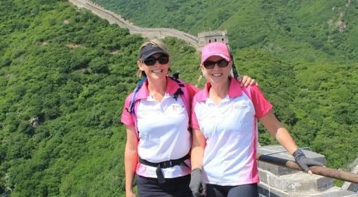
The Adventure Angels on The Great Wall of China.
After successfully completing their very first multi-day and international hike along The Great Wall of China, Liz and Di were exhilarated. However, on returning to Australia, they realised they had accomplished more than just a hike, they had created something so valuable in the hiking group, that they just couldn’t stop.
“The momentum snowballed from there”, Liz says, “and in the months afterwards we were training and completing Coastrek 30- and 60-kilometre charity day-hikes all over Australia, from the Fleurieu Peninsula in Adelaide, the Mornington Peninsula in Victoria, to Bondi and Palm Beach in Sydney”. Together the group hiked the 125km multi-day Cape to Cape Walk in southern Western Australia - the highlight being able to combine hiking with incredible beaches, wine and food!
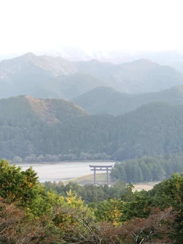
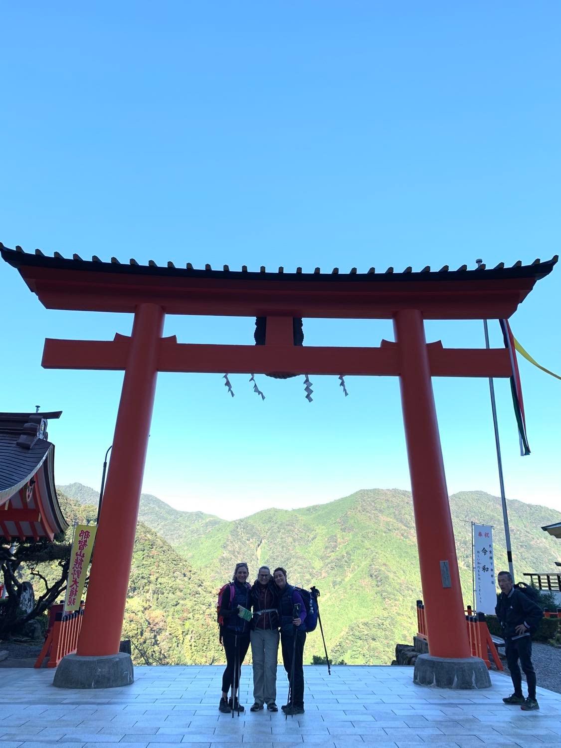
In late 2019, Liz, Di and I (Meg), walked the Kumano Kodo pilgrimage trail in Japan. Together they hiked the 4 day Nakahechi route from West to East across the Kii peninsula, with the highlight being the Kumano Hongu Taisha temple, deep in the middle of the peninsula. After so many hikes together, Liz and Di developed a post-hike recovery tradition of icy cold beer and hot chips.
Highlight of the Kumano Kodo: The Kumano Nachi Shrine and Nachi Falls.
Liz and Di’s families and children are incredibly supportive of their new found love of adventure, and can see how hiking has changed their lives. Di recalls, “I’d never been exposed to much sport growing up, so I’m proud of myself at my age for doing what I’ve done physically and mentally, and on the back of that, also forging friendships I’ll have for life. Now, nothing is a barrier for me.”
The Adventure Angels group travelled to Western Australia to hike the Cape to Cape Track, a 123 kilometre trail along the Leeuwin-Naturaliste Ridge, between the lighthouses of Cape Naturaliste and Cape Leeuwin in the Margaret River region in the far south west of Western Australia.
From two friends to a group of at least 6 women, The Adventure Angels have found support, fitness and friendship in their regular sunrise hikes. While the COVID pandemic and long lockdowns in Australia have made it difficult for the hiking group to get together in the last 18 months, Liz and Di are determined to keep the group hiking together as often as they can.
With their sights set on Machu Picchu and the Via Alpina in Switzerland, The Adventure Angels are only just getting started. Together they are committed to hiking for as long as they can, both questioning: “Why didn’t we do this sooner?”
Author: Meg Appleby, Die Basler Wanderdamen hiking group
Meg always enjoyed being outside but an unexpected relocation from Australia to Switzerland plonked her in the outdoors equivalent of Mecca. Inspired by the über-fit Swiss she met on her day-hikes, Meg co-founded a hiking group and walked The Haute Route with the help of The Hiking Club. She lives to hike/snowshoe most weeks all over Switzerland and can’t think of a better pastime as she negotiates major mid-life changes.
The Hiking Club empowers anyone to walk the way they want in the wild with personalised self-guided hiking experiences that are easy to find, quick to plan and simple to navigate.
We believe hiking experiences have the power to transform lives. With a growing range of personalised hikes that take into account your preferences, fitness and interests, we give you everything you need to explore the legendary trails of the world!
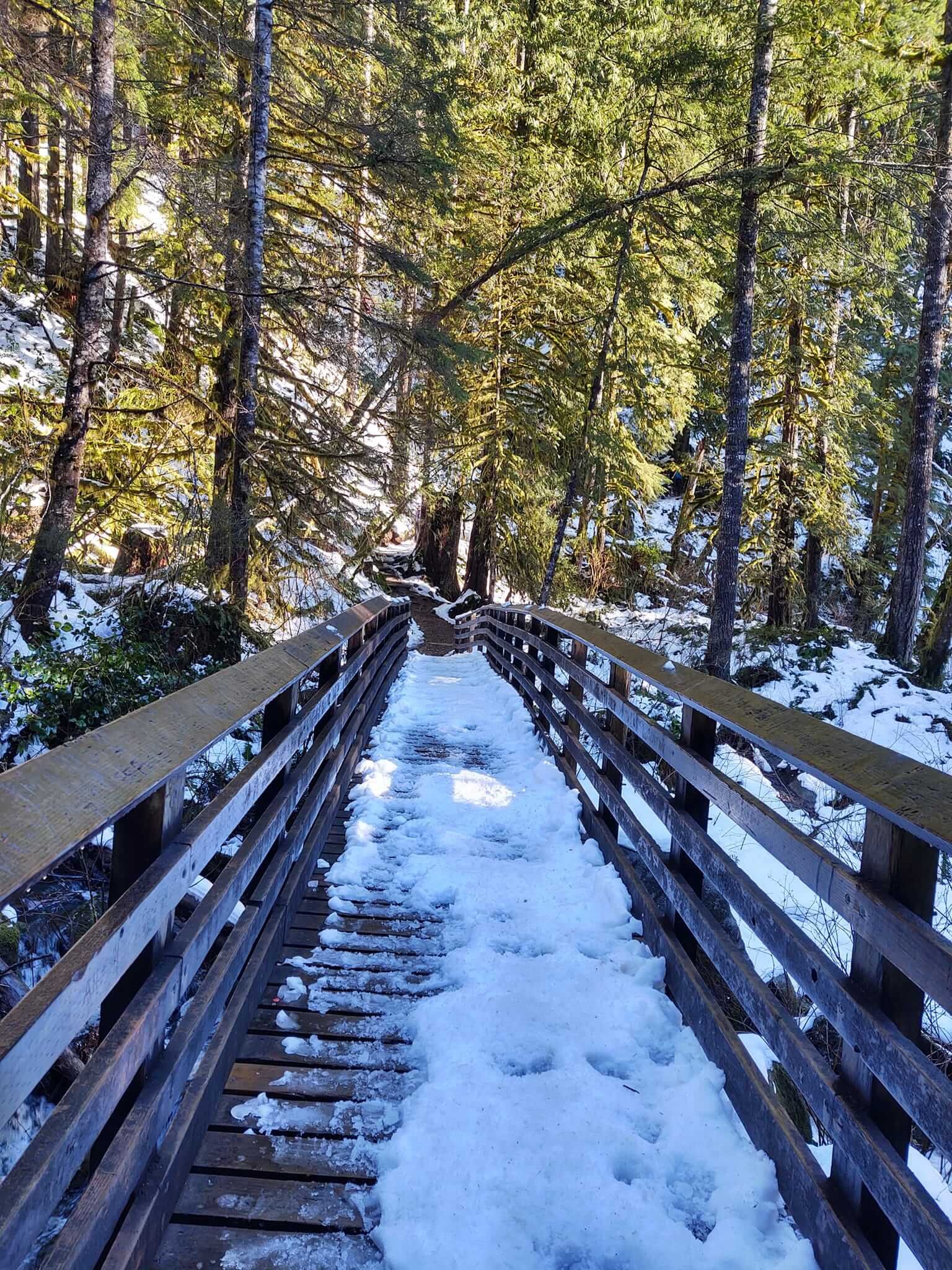
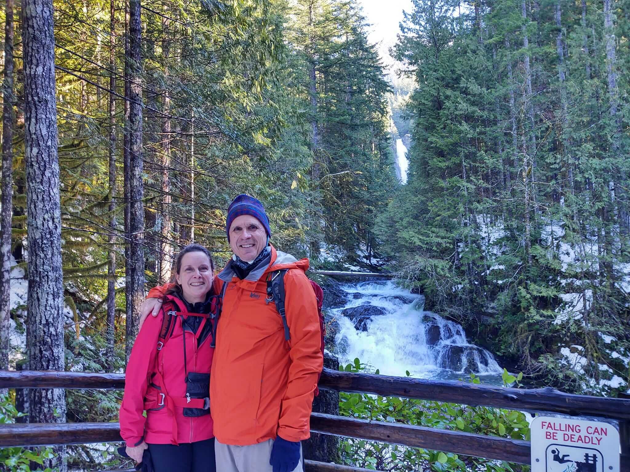
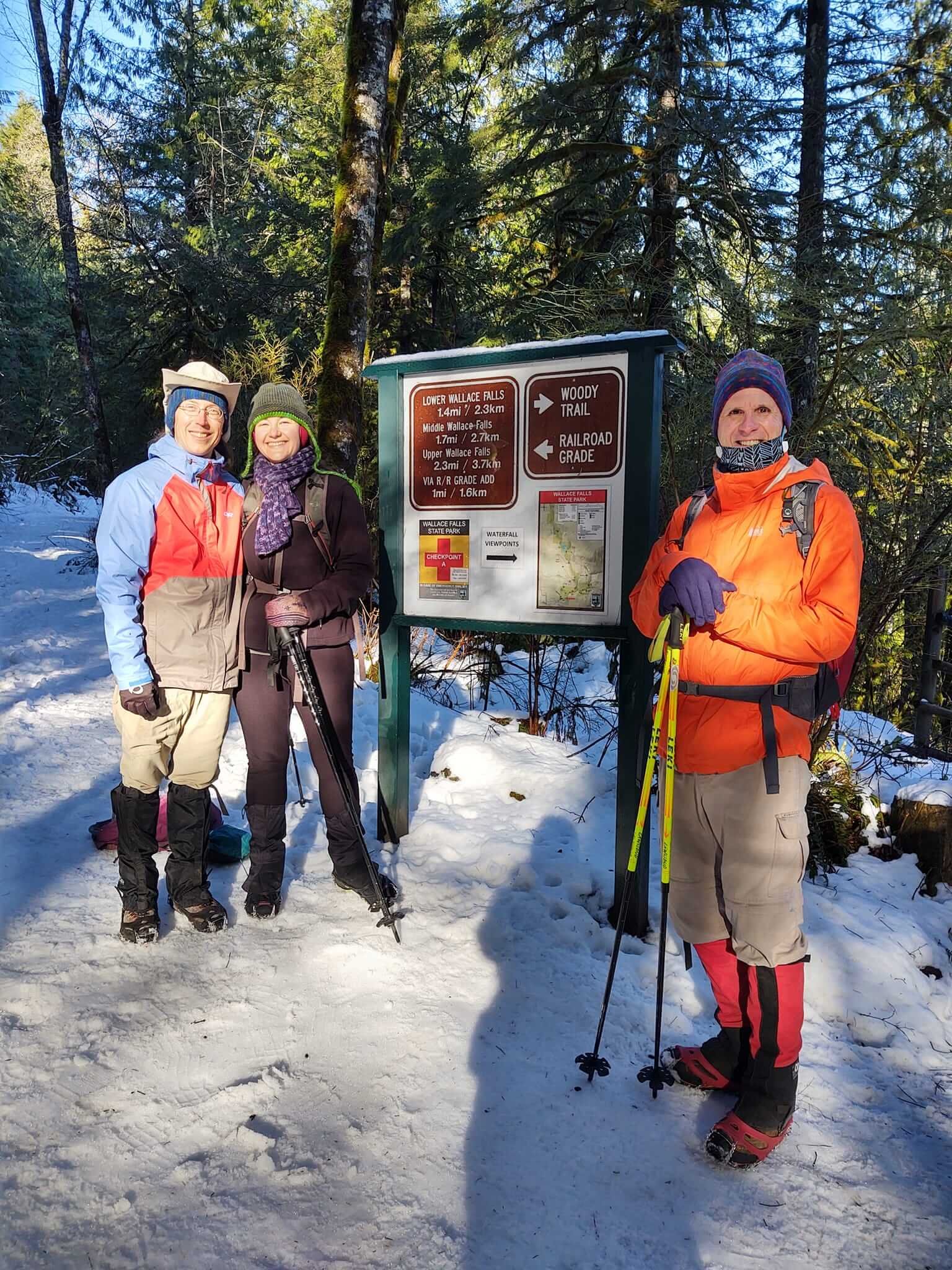
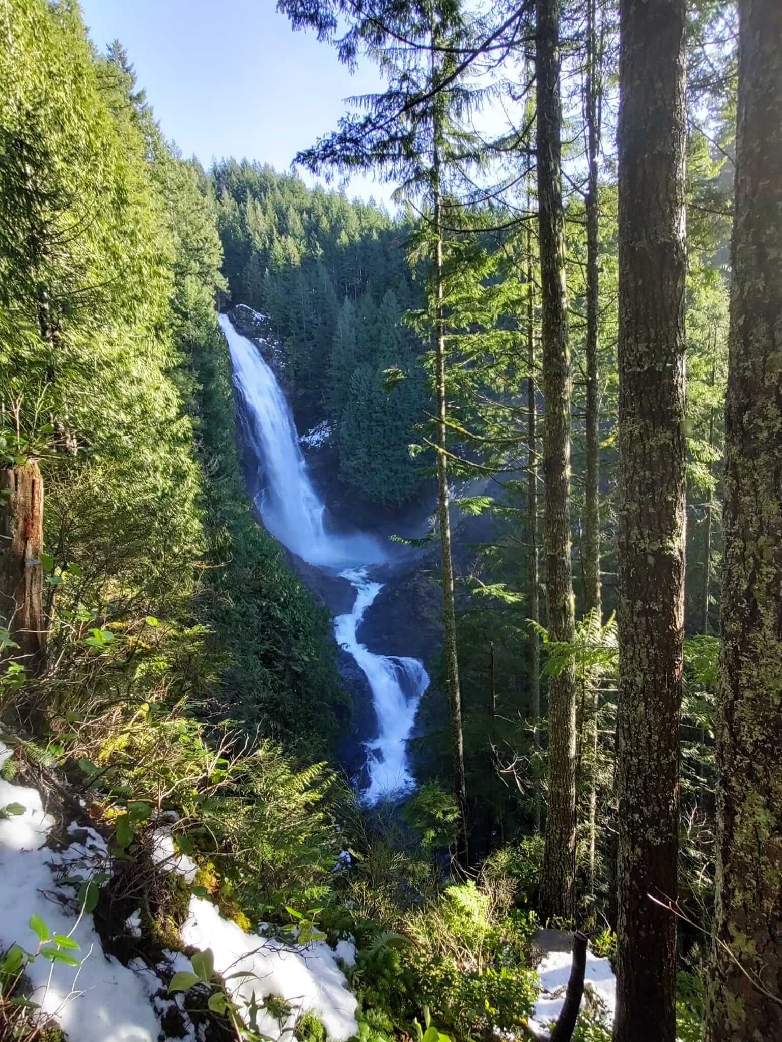
Cindy Scheyer is the winner of The Hiking Club competition that ran alongside our New Year’s Day Global Hike Event 2022. Cindy lives in Seattle, USA, and is an avid hiker. Cindy shares her new year’s hiking adventure to Wallace Falls State Park, a 5.6 mile / 9 km out and back hike with 1300 ft / 396 m elevation gain.

Discovery Park, Seattle on New Year’s Day.
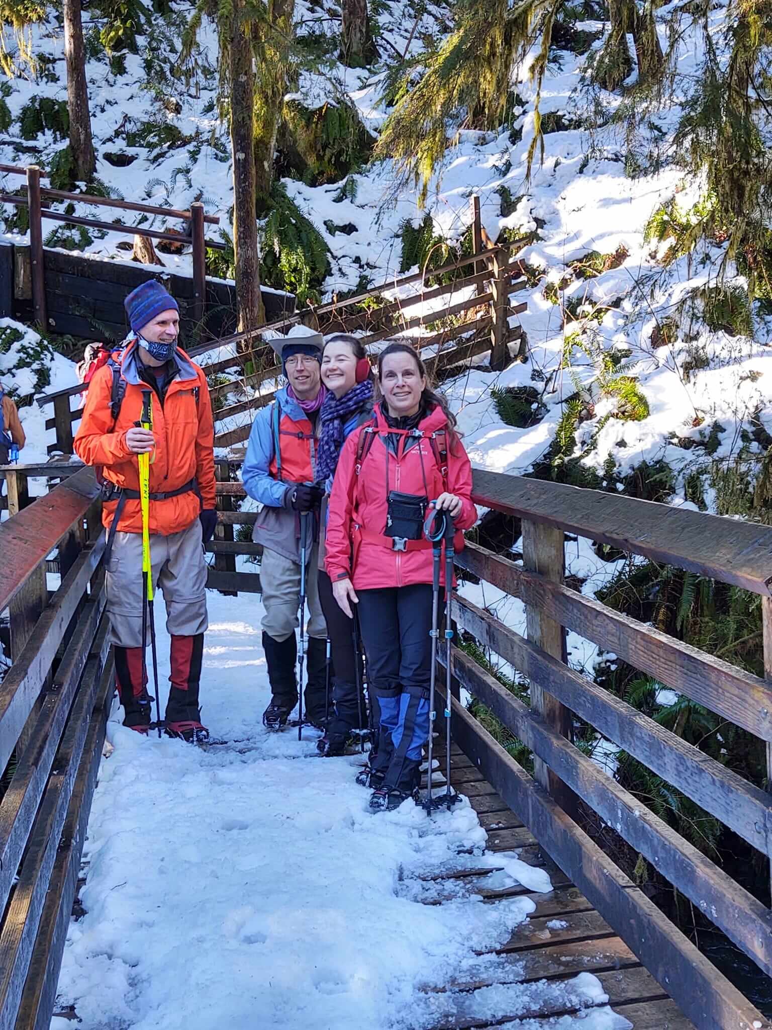
After stepping out on the right foot for a hike on New Year’s Day in Discovery Park, we opted for a longer hike to Wallace Falls the following weekend. I hiked with my partner, Bob Hamilton, and friends John and Koren.
It was a sunny Sunday hike in the snow! After one week of sub-freezing temps and lots of snow, both unusual for Seattle, followed by another week of torrential, record-breaking rain, we were ready for a sunny day in nature! We chose the Wallace Falls hike, a pretty gentle trail, about a 5 mile (9 km) round trip with an elevation gain of 1300 feet (396 metres). You can read more details about the hike itself here.
The rain we had in Seattle translated into heavy snow in the mountains and caused the department of transportation to close all four of the major mountain passes in the state, literally cutting most people off from hiking and skiing in the mountains, and for good reason, since the avalanche danger was super high.
Wallace Falls is reached on the same highway which was closed over Stevens Pass due to slides, avalanches and 4 inch thick ice. Fortunately, the trailhead starts about 30 miles before the road closure.
It was great to be outside with friends in the sunshine on a bluebird sky day! We weren’t the only ones escaping the indoors, as the trail was crowded with other like-minded hikers. We all wore microspikes anticipating the compact snow and ice on the trail although we noticed many other hikers didn’t and were having a hard time coming down the trail.
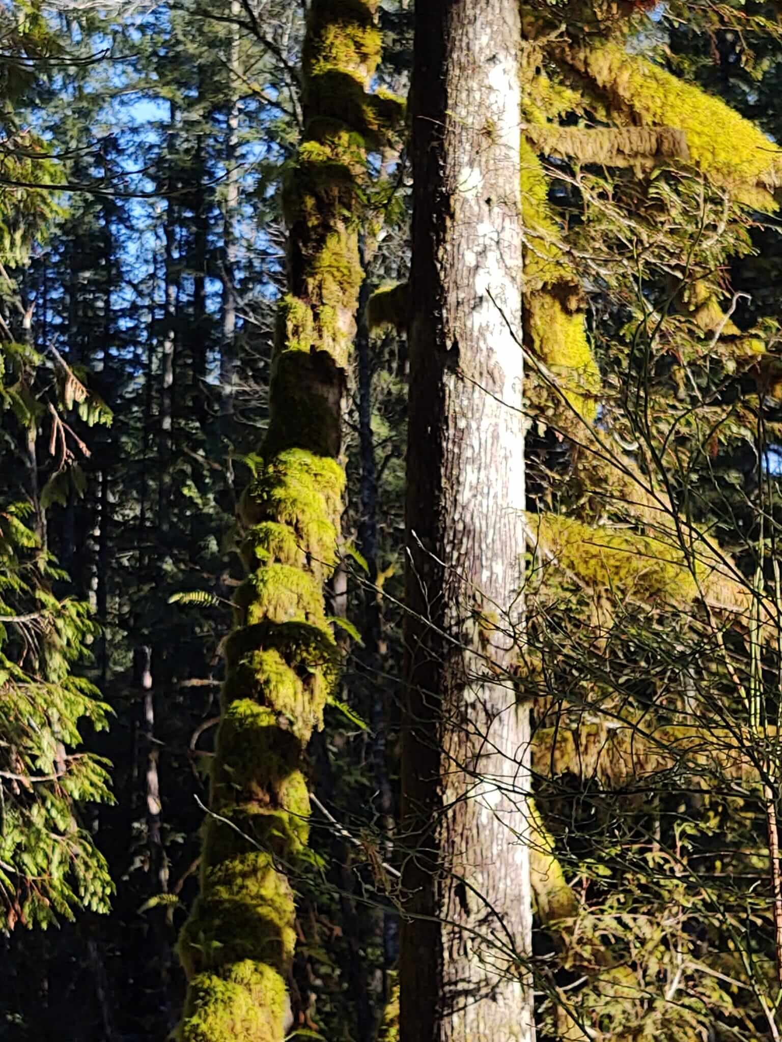
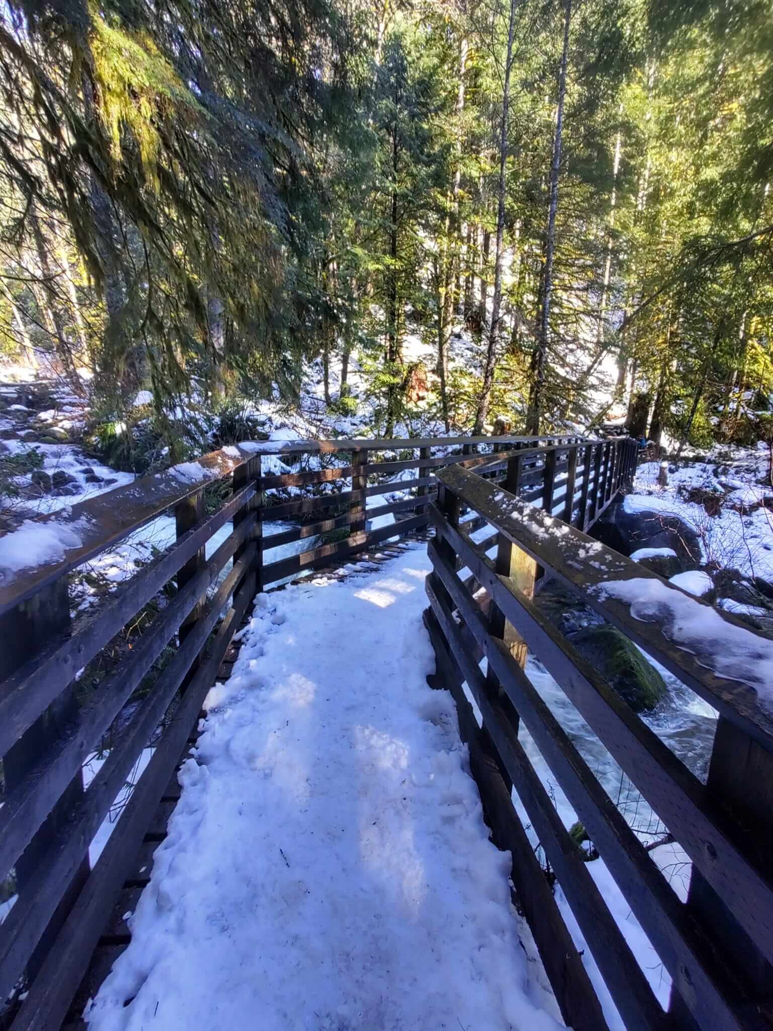
The hike is through a heavily wooded area with gorgeous views of the multiple falls from scenic wood bridges and along the way. As it’s a state park, the trail is well-maintained. The views of Middle Falls are especially stunning! Eating lunch with the sound of the falls nearby was just about perfect.

While we love moments like these on the local trail, Bob and I are looking forward to more international hiking trips in the Swiss and French Alps, Austria, Norway and Machu Picchu. Our bucket list of hikes is pretty long!

We hiked the Walker’s Haute Route in September 2019 following The Hiking Club’s self-guided program, which was wonderful, and we had planned to do it again in 2020, but our plans were disrupted with the pandemic. In the meantime, we’ve been staying busy hiking in the Cascade Mountains in Washington and Oregon states, the Tetons in Wyoming and hikes near Moab, Utah in the La Sal mountains in Manti-La Sal National Forest. If European hiking isn’t open (or easier to access) in the summer of 2022, we will continue to keep our hiking adventures local and hope to hike in Glacier National Park in Montana, and maybe the Sunshine Coast of British Columbia in Canada.
I just love The Hiking Club community! It's so motivational and inspirational to see everyone's photos and read about your adventures. Wishing you all a wonderful year of hiking!
— Cindy S.
All photos by Cindy Scheyer.
The Hiking Club empowers anyone to walk the way they want in the wild with personalised self-guided hiking experiences that are easy to find, quick to plan and simple to navigate.
We believe hiking experiences have the power to transform lives. With a growing range of personalised hikes that take into account your preferences, fitness and interests, we give you everything you need to explore the legendary trails of the world!
Pieter Boddaert from the Netherlands confronts his expectations and disappointment while hiking along the Kesch Trek, a 36.1 mile / 58 km point-to-point trail located near Davos, Graubünden, Switzerland.
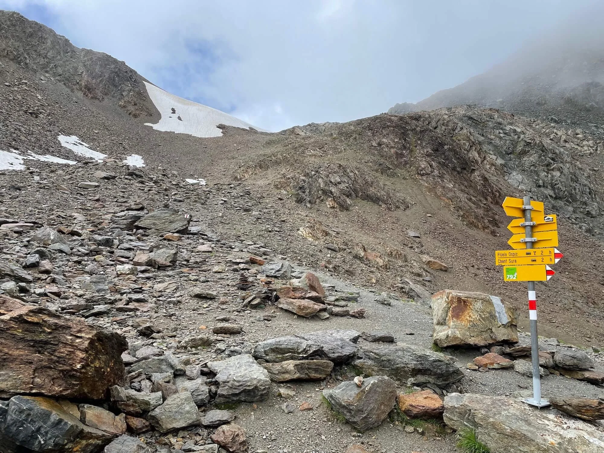
Last summer I did a twelve day thru hike in the Swiss Alps. The backbone of this hike was the Kesch Trek, a classic four day hike that runs in the canton of Graubünden. It starts at the Flüela Pass and ends in the charming village of Bergün.
I visited Bergün as a young boy during a family holiday. When my father invited me to hike to the Kesch Hütte together with my brother, I declined. I preferred to spend my day reading comics at the Bergün swimming pool. When I grew up and became an avid hiker, I always regretted that decision.
Now that I finally hiked the Kesch Trek, I met quite a few challenges. The first mountain hut on the trail, the Grialetsch Hütte, was closed for the season, which forced me to hike the trail in three instead of four days. Moreover, right at the start I discovered my water filter failed (which meant limited water), and I wounded my right foot in a clumsy way. However, my greatest challenge was how to deal with the bad weather.
Kesch Trek: Flüela Hospiz with the Schwarzhorn. Photo: Pieter Boddaert
I woke up at the Flüela Hospiz in a dense fog that blocked all views of the mountains. Especially the Flüela Schwarzhorn, which I planned to summit that day, was entirely invisible. It was still misty when I left the Hospiz for the trailhead on the other side of the pass. Ascending into the mountains towards the Schwarzhorn, herds of curious sheep on the trail seemed to be questioning me with their tilted heads: what are you supposed to do here? A good question indeed, because most of the time I could not see more than fifty meters in front of me. And when the mist cleared, snow and hail started to fall from the dark sky. I began to doubt my plan to climb the Schwarzhorn summit.
From the trail crossing to the Schwarzhorn, the summit would take about two hours up and down. The mountain was enclosed in a thick fog, its summit invisible. I sat down on a slab of rock, disappointed by the fog obstructing all views, just like the day before. Would it be worth the effort, knowing that I wouldn’t see a thing up there? Why waste two hours of hiking in the mist, I wondered. What finally made me push on, was the idea that reaching a 3,000 meter summit would be a personal record.
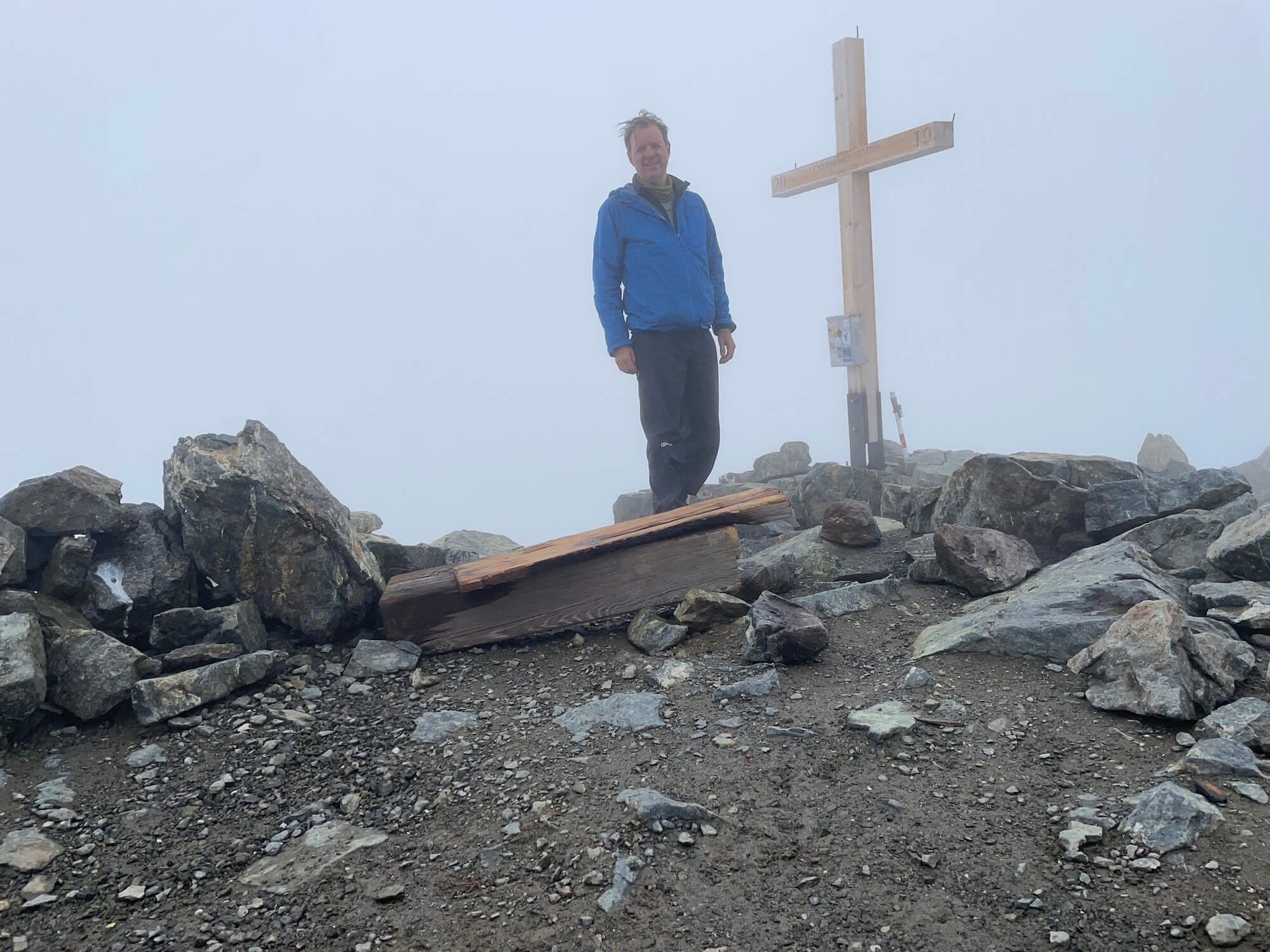
But it was hard. I followed a steep and rough trail up to the snowfields and further along a narrow ridge. I walked deeper and deeper into the mist until I really couldn’t see more than two meters in front of me. The sharp rocks to my left and right acted as a fence between me and an unfathomable depth. Then, after an hour of climbing, a pale wooden cross loomed in front of me: I had reached the summit.
Now I was completely contained by the white fog. I would not have been able to tell whether I were on a summit or in a deep cave, if not for the cross with “3147 m” carved in the wood. It was cold, wet and I felt disappointed. I had hoped that the sky would clear, and that I would be granted an epic view from the summit.
I sat down, thinking about my situation. About the clouds, the mountains and the rain. I began to realize that all were part of a greater natural system. The water that I love so much when it streams in a wild mountain brook; the water I swim in on a hot day; or the water I drink from a clear stream – all this water comes from the clouds, the rain and the snow. This never ending cycle of raining, streaming and evaporation is what has shaped the mountains, what gave life to all beauty in the Alps. I decided to embrace the fog, to be thankful for the silence up here at the summit, and to appreciate the mysterious lightness of the clouds so close to me.
Looking back from the Scaletta pass to the Schwarzhorn. Photo: Pieter Boddaert
I left the Schwarzhorn summit and descended back to the trail crossing, where I saw two other hikers going up. Just like me they persisted in their effort, despite the thick clouds above.
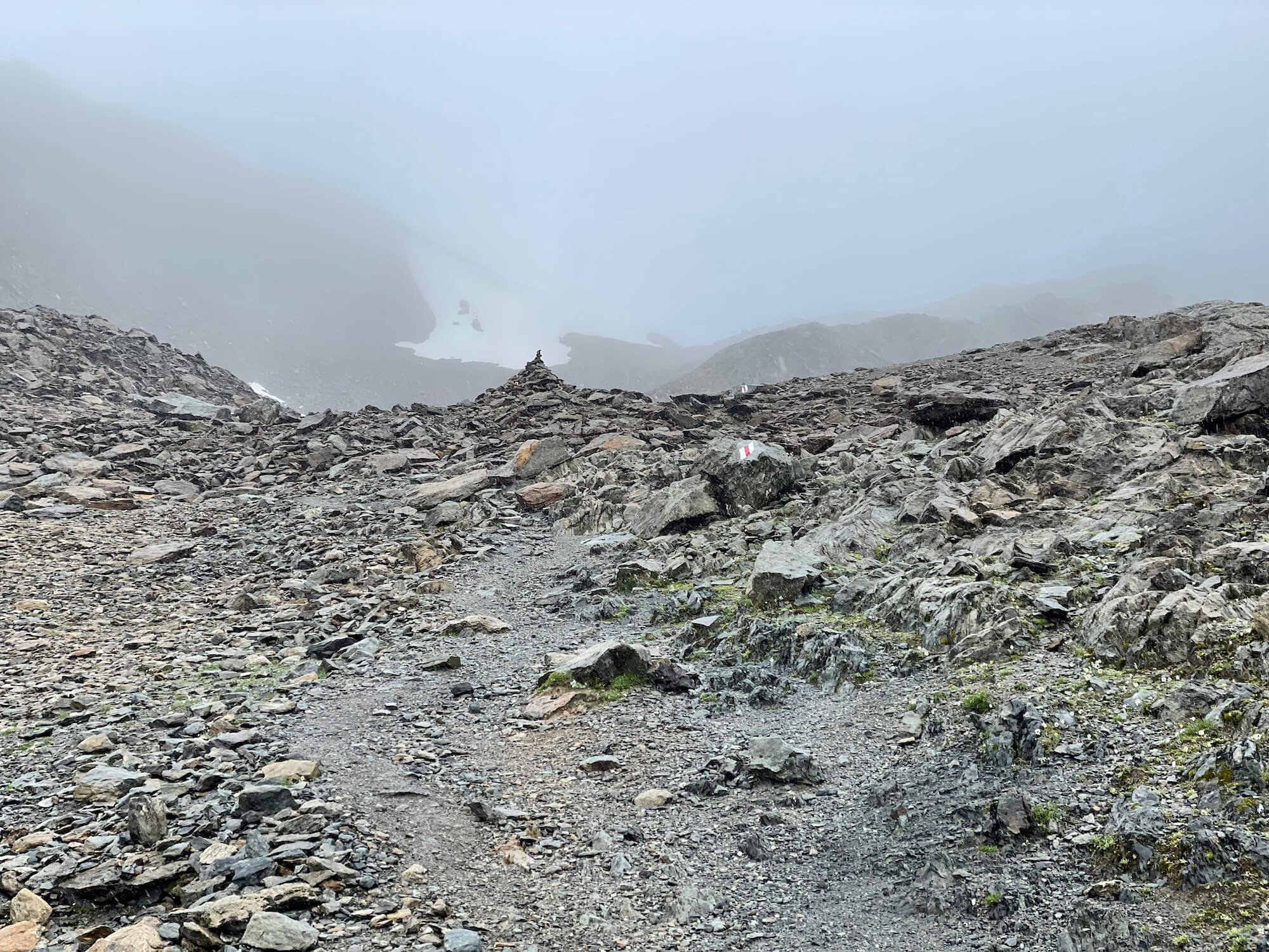
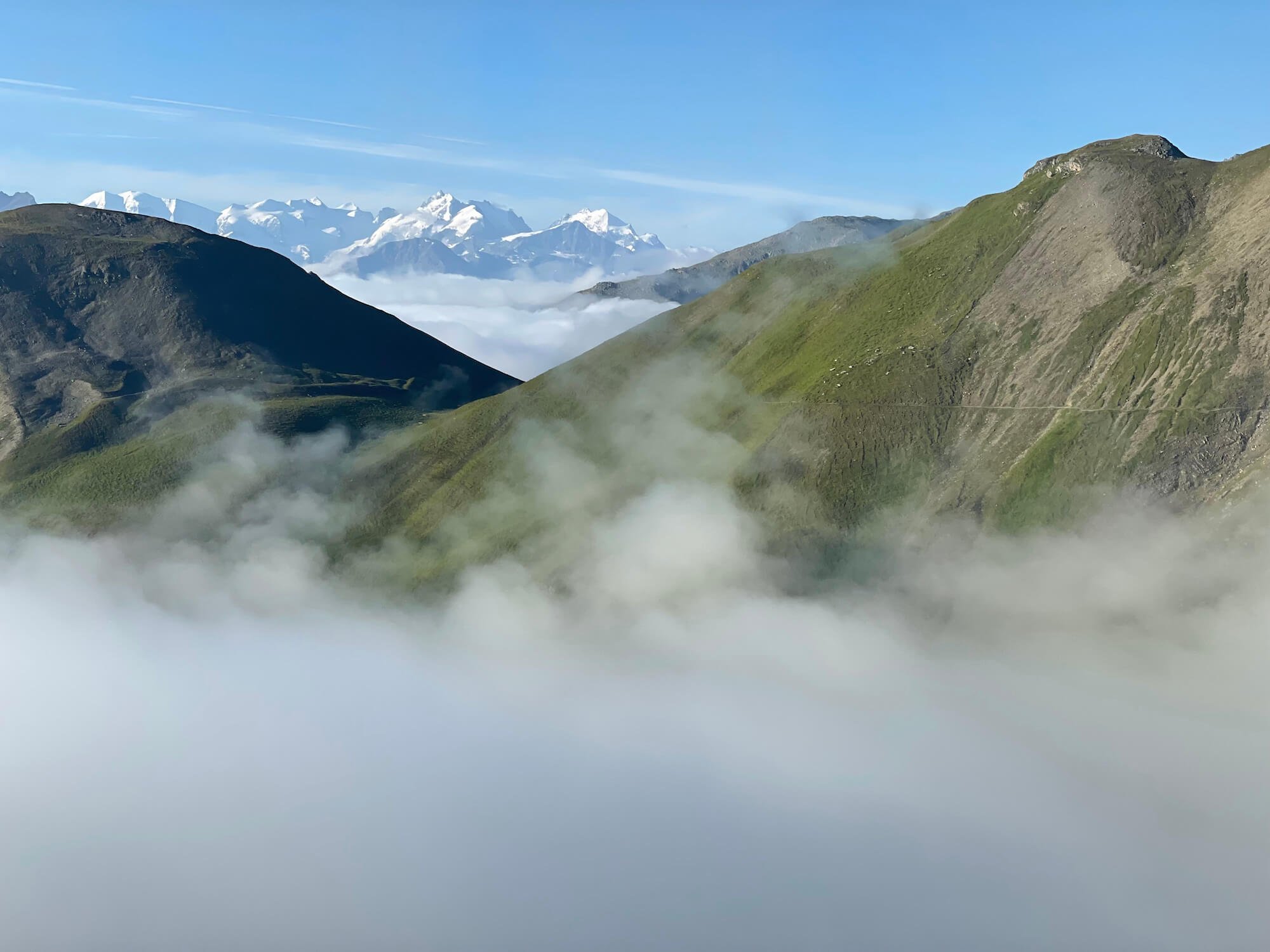
Then the sky cleared. In front of me emerged a massive field of scree. A faint line crossed the grey mass, the trail to the next pass.
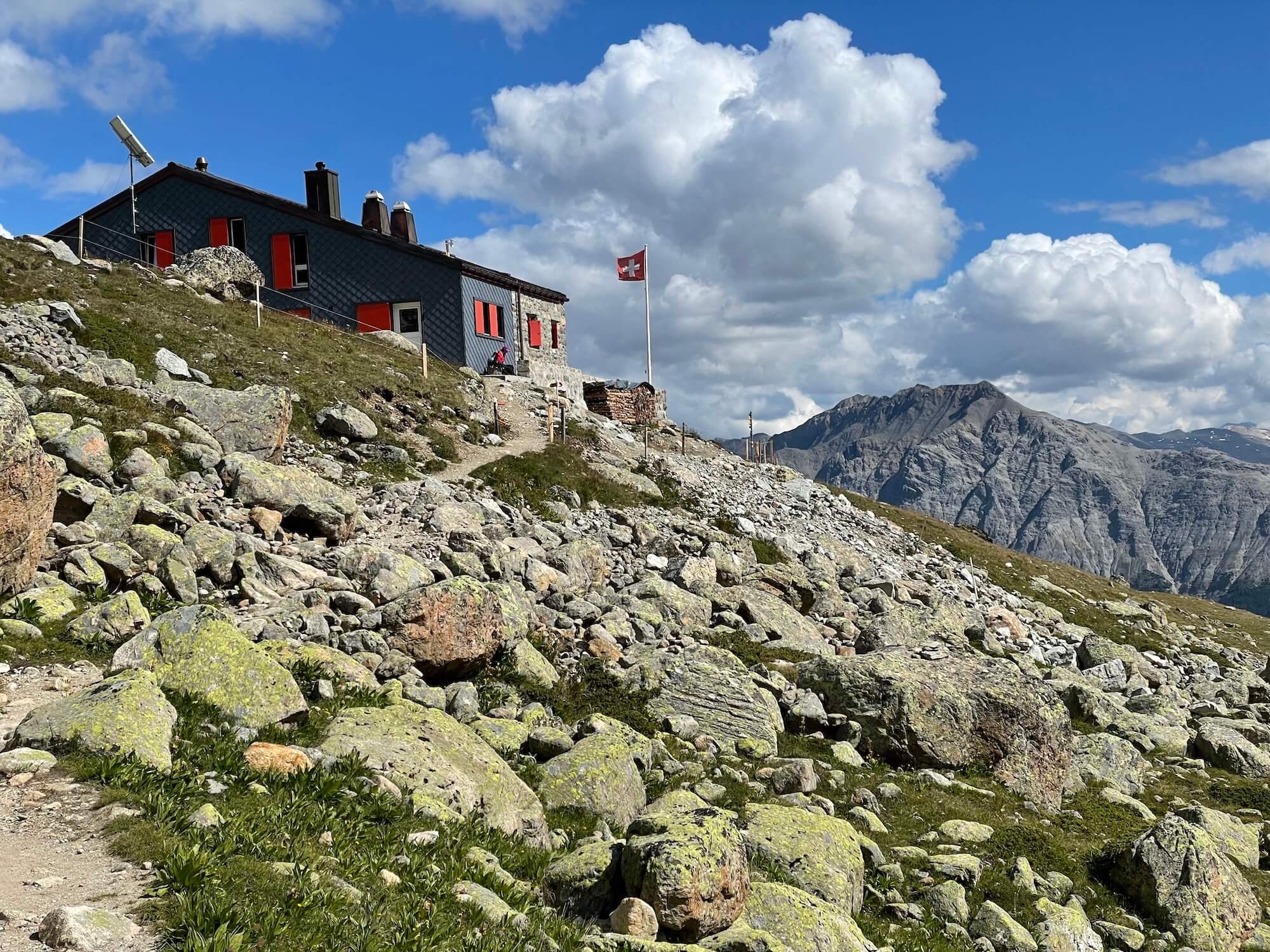
Kesch Trek day 2: at the Kesch Hütte. Photo: Pieter Boddaert
I hiked on, passing the closed Grialetsch Hütte, all the way to the shelter at the Scaletta pass, where I drank unfiltered water from a stream below it. The next day I hiked to the Kesch Hütte, followed by a gruesome climb up the Pischa pass. Finally I arrived at the wonderful Chamanna d’Es-cha, where I drank one liter of Shorley apple cider. The third day brought a dense fog in the morning once again, but the trail was comparatively easy: a more than 1,000 meter descent to the village of Bergün.
The Kesch Trek was amazing and spectacular. Looking back, the ascent of the foggy Schwarzhorn had been one of the highlights. I had finally learned that in the Alps, bad weather days can be just as sublime as those lazy days by the swimming pool.
Author: Pieter Boddaert
Pieter lives in The Netherlands, a very flat country with a surprising number of mountain enthusiasts. Pieter has thru hiked among others the Tour du Mont Blanc and the Haute Route in the Alps. In the USA he hiked in Utah, Arizona and in California, where he hiked the SEKI loop. In daily life Pieter works as an independent editor and graphic designer.
Blog: overseashiker.com | Instagram: @overseashiker
The Hiking Club empowers anyone to walk the way they want in the wild with personalised self-guided hiking experiences that are easy to find, quick to plan and simple to navigate.
We believe hiking experiences have the power to transform lives. With a growing range of personalised hikes that take into account your preferences, fitness and interests, we give you everything you need to explore the legendary trails of the world!
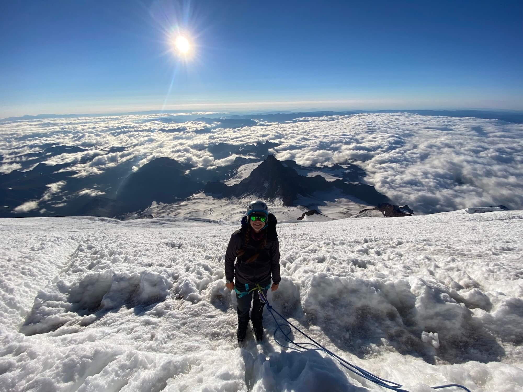
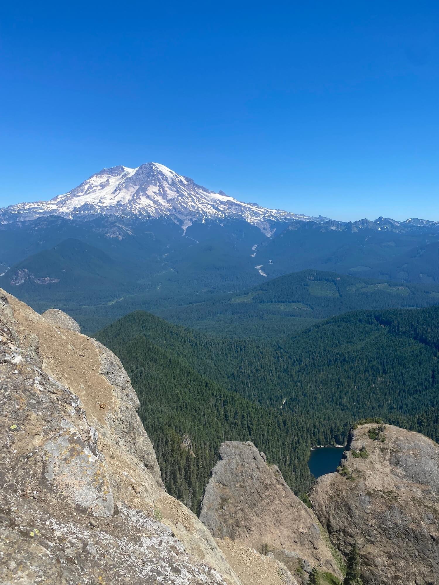
Views of Mt Rainier from the Wonderland trail. Photo: Sam Goldklang
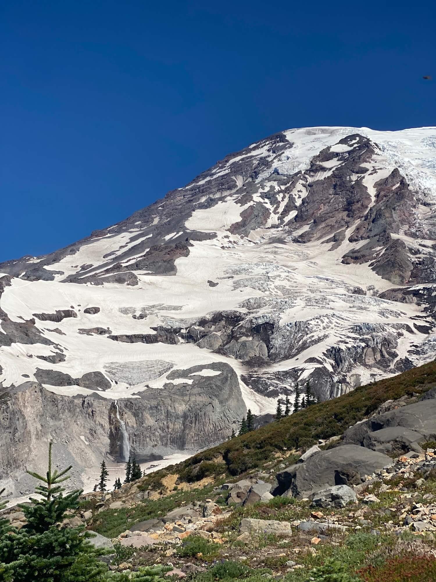
Mount Rainier is a 14,410 ft (4392 m) active volcano that dominates the sky in Washington state, US. When locals ask, “Is the mountain out?” they’re always talking about if you can see Mount Rainier while walking around Seattle, from the summit of another peak in the Cascades, or driving south on i90. This peak was known to Native American tribes as Tahoma, which translates to the source of nourishment from the many streams coming from the slopes, or the “white mountain”.
Mount Rainier is the most glaciated peak in the contiguous U.S.A., with 25 major glaciers. Under all the ice and snow is an active volcano. It is the definition of a world of ice and fire. The volcanic activity began one half to one million years ago with the last small explosion occurring about 125 years ago. Mount Rainier is predicted to blow its top sometime in our lifetime…hopefully not any time soon!
The view on the way to the Mt Rainier summit. Photo: Sam Goldklang
Mount Rainier is a nature lover’s paradise with endless trails, over 200 species of wildlife, awe-inspiring views, rushing rivers, towering glaciers, and beautiful wildflowers in the summer. Activities are endless including day-hiking, mountaineering, backpacking, through hiking, snow shoeing, and in bound and backcountry skiing.
Mount Rainier National Park is a bucket list destination for hikers. If you’re thinking about a trip to this national park here are a few reasons to take the plunge…
There’s over 200 miles (321 km) of trails of varying distance and elevation for all ability levels. Here is a few of the highlights with top notch views:
Mt Rainier from the Burroughs at sunrise. Photo: Sam Goldklang
Volcano views in the distance. Photo: Sam Goldklang
Skyline trail to Panorama point: 5.4 mile loop with 1700 ft elevation gain (8.7km, 518m). This hike is located in the Paradise area of Mount Rainier National Park and truly lives up to its name: wildflowers galore and views of Mount Rainier, Mount Adams, Mount Saint Helens, and Mount Hood on a clear day.
Burroughs Mountain trail: This hike follows a series of 3 burroughs (peaks) in the Sunrise area of Mount Rainier and puts you face to face with the mountain. You can go out and back to the first or second burrough or do a 9.4 mile (15km) loop to hit all 3 with 2562 feet (780m) of elevation gain with a high point of over 7800 ft (2377m). Hike it at sunrise to watch the mountain glow pink!
There are 4 historic fire lookouts, structures built to watch over millions of acres of forests, in Mount Rainier National Park. Two of the most popular are:
Mount Fremont lookout: This hike is also located in the Sunrise area and is 5.6 miles round trip with 900 ft of elevation gain (9km, 274m).
Tolmie Peak Fire lookout: 6.5 miles and 1010 ft of elevation gain (10.5km, 308m). This is named after Dr. William Tolmie who sailed to Fort Vancouver from London. After he saw “The Mountain”, he was entranced and had to take a trip to collect herbs to make medicine. It is located in the Mowich Lake area of Mount Rainier.
Mount Rainier National Park became the fifth national park in the United States in 1899. One of the best ways to experience the diversity of the area is with a multi-day hike. The prime hiking season to explore Mount Rainier is between late July and into September, when high-mountain trails are free of snow.
Reflection lakes, Mt Rainier National Park. Photo: Sam Goldklang
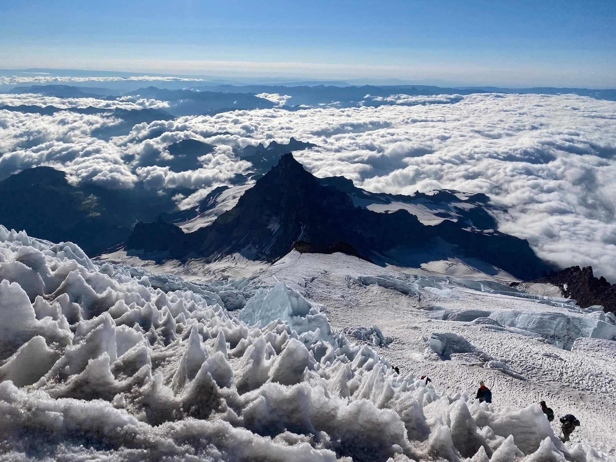
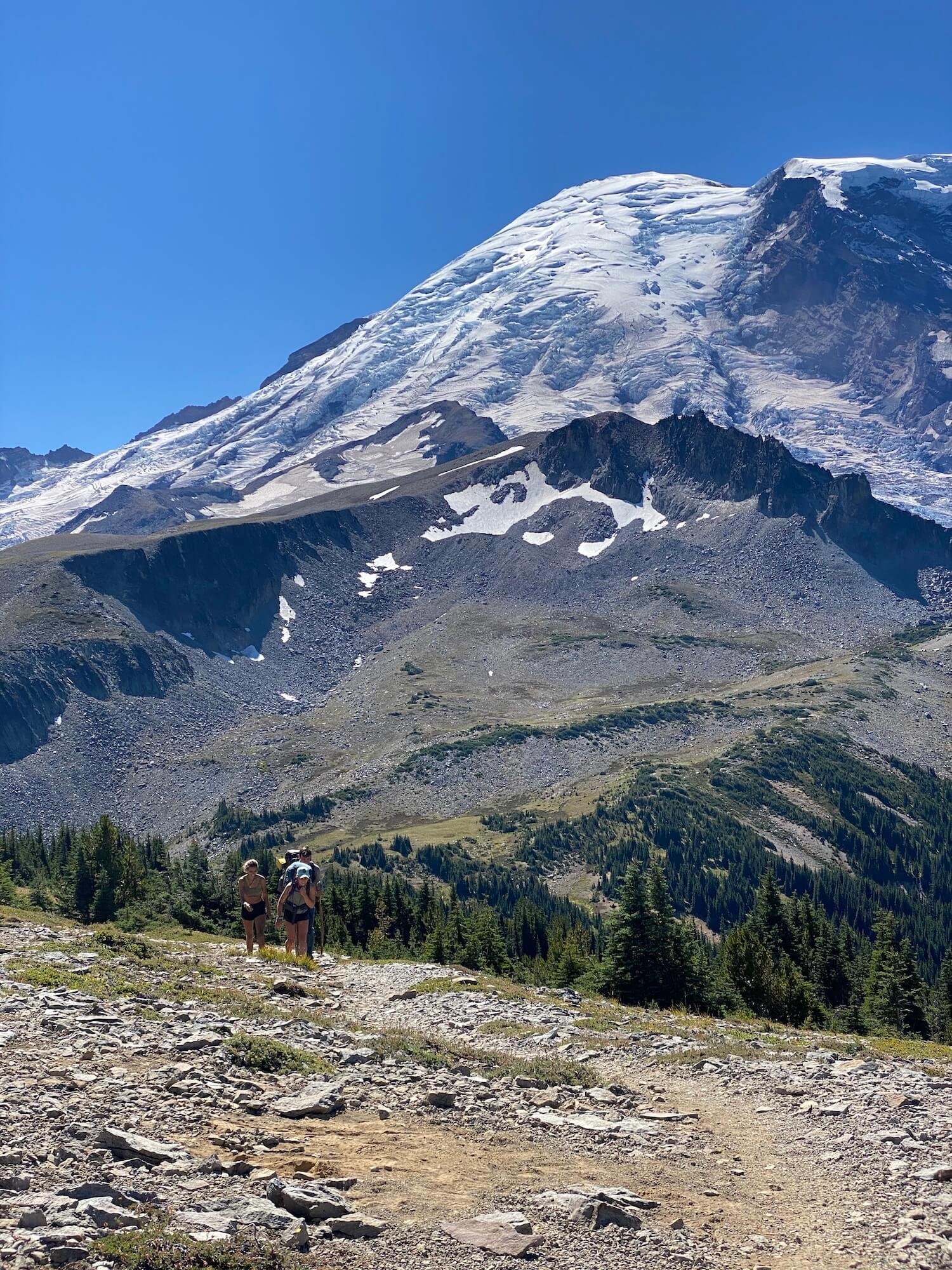
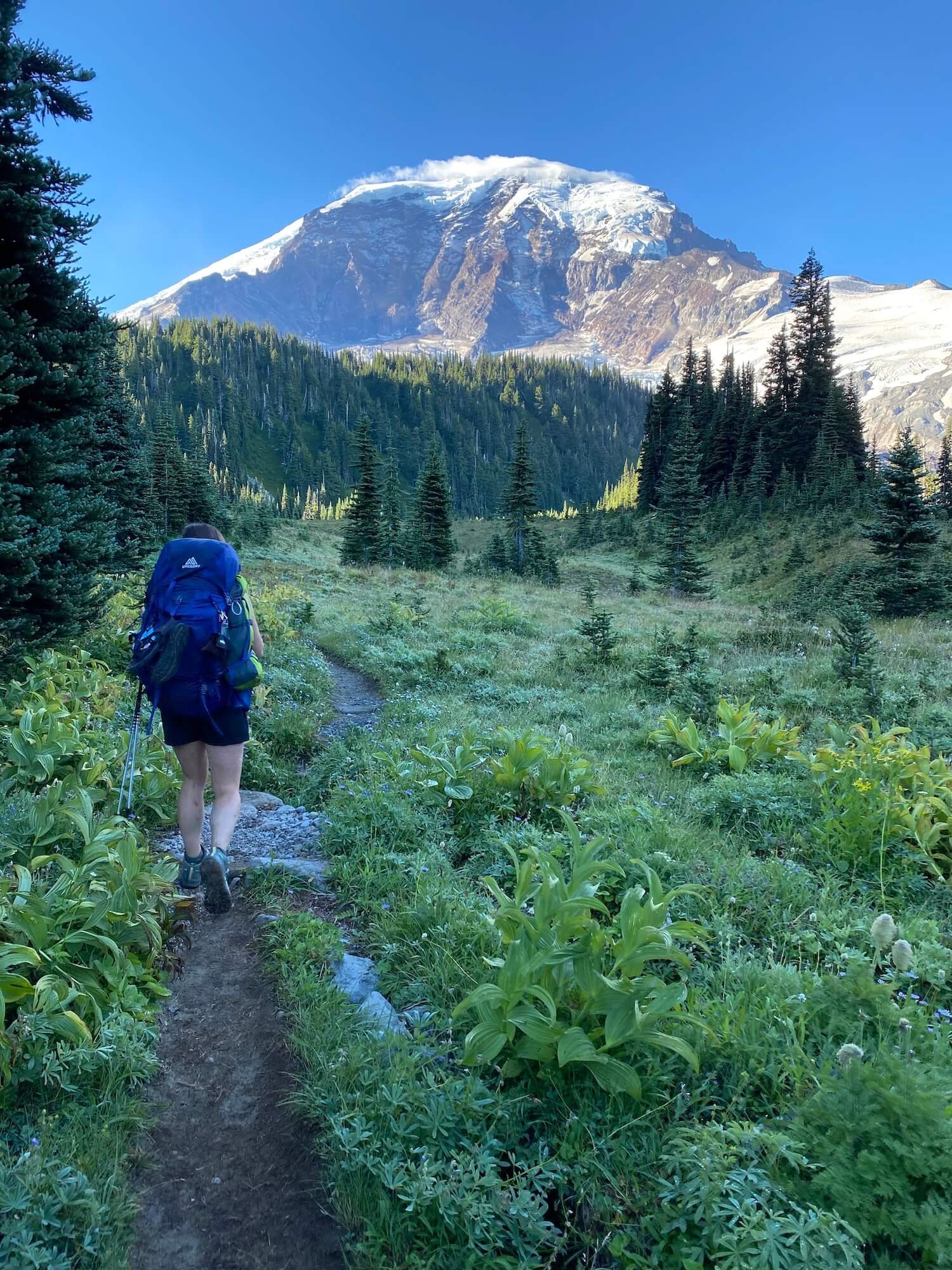
The Wonderland Trail: - a 93 mile (150km) loop circumnavigating Mt Rainier where you get up close and personal with this beautiful volcano from all angles. Wonder is an understatement. The fastest known time to complete the trail is 16 hours 40 minutes 55 seconds, but most people complete the trail in 8-13 days. Permits are required for backcountry campsites but snagging them is like finding the golden ticket.
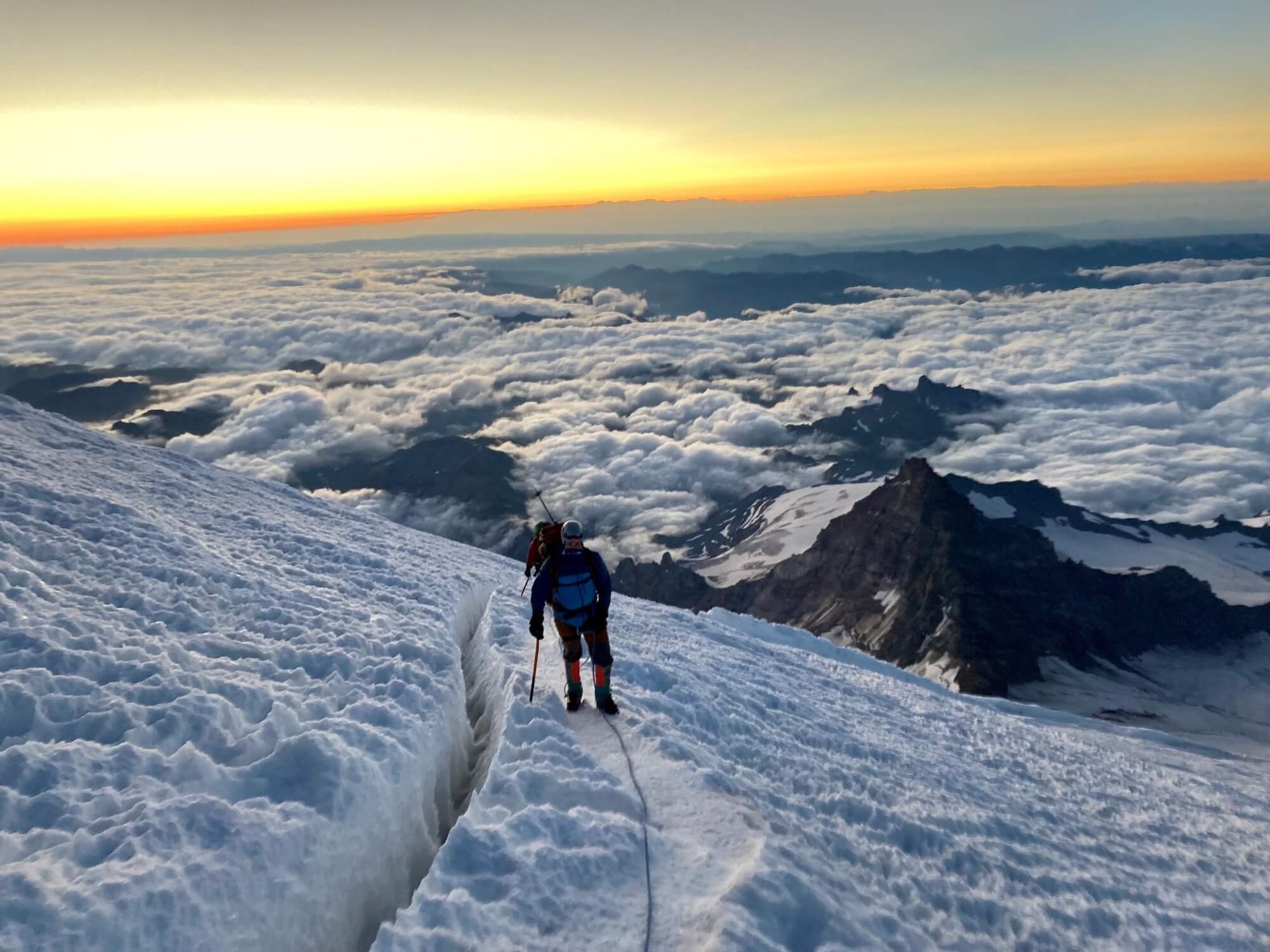
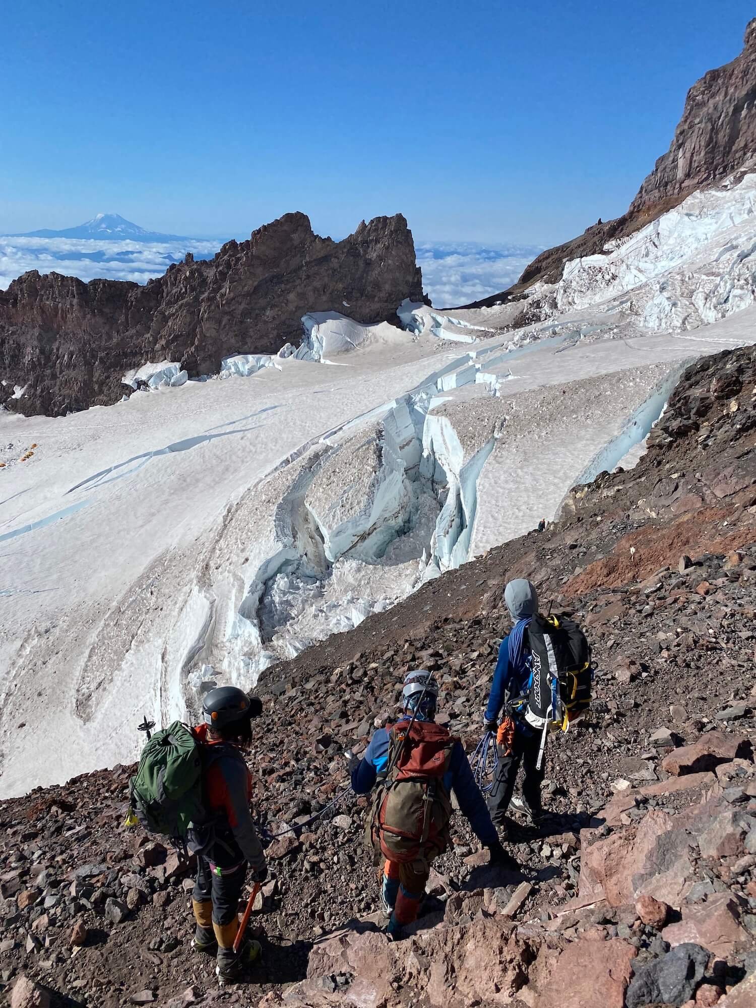
Mount Rainier summit: climb to stand on the 5th highest peak and tallest volcano in the lower 48 states. There are various routes to climb and/or ski this volcano but there is at least 9000 ft (2743 m) of elevation gain in the shortest approach and technical mountaineering gear and rope skills are necessary. You can climb it guided or if you have the necessary training and preparation you can get permits (necessary above 10,000 ft / 3048m) to climb it as an independent team. Some people climb this beast in a single day while others spend 1-2 nights on the mountain to acclimate, break up the climb, and watch the sunrise from up high.
Nearing the summit at sunrise. Photo: Sam Goldklang
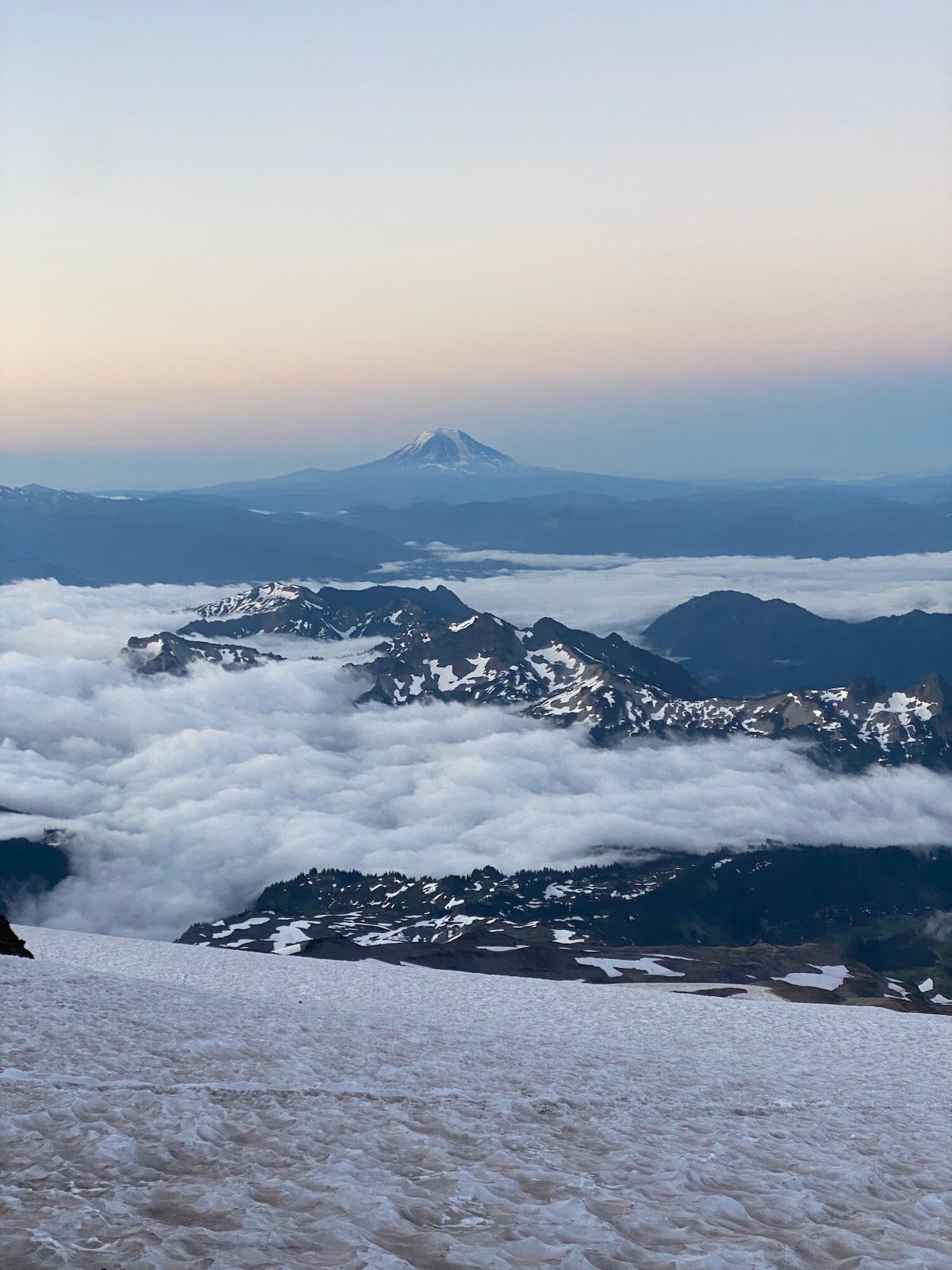
Camp Muir: Sitting at 10,188 ft (3105m), Camp Muir is the highest you can climb on Mount Rainier without a permit. This climb is mostly snow covered year round and may require crampons and an ice axe, microspikes, or climbing skins and skis. The views of distant volcanoes and mountain peaks are breathtaking.
Camp Muir is a popular destination on its own or a stop on the way to the summit.You can tent camp on the glacier but there is also a guide hut and a climbers hut. During John Muir’s 1888 summit of Mount Rainier, he had suggested the area as a good place to camp due to the false belief that it would provide shelter from the wind. It was then named “cloud camp” and later renamed Camp Muir. (Read John Muir’s essay documenting his 1888 ascent of Mount Rainier here.)
There are many ways to enjoy the grandeur of Mount Rainier National Park. Whether it be a casual walk through the park to see the wildflowers, a longer day hike to a find a look out or close up view of the queen, an overnight backpacking trip to soak it all in, or a lifetime goal of a summit push, a trip to this National Park will amaze and inspire you.
Author: Sam Goldklang, USA
Sam is an everyday adventurer who resides in Washington State, USA. She has completed the Wonderland trail and summitted the 5 tallest peaks in the lower 48 states, including Mt Rainier. Sam has hiked around the world with some of her notable trails being: the Tour Du Mont Blanc in the Alps, The Kepler and Routeburn tracks in New Zealand, the Salkantay Trek in Peru, the Mt Toubkal trek through the Atlas Mountains in Morocco, The Fisherman's trail in Portugal, and Trolltunga in Norway. Sam spends her days working as a Pediatric Nurse Practitioner and on the weekends she'll be hiking, camping, trail running, backpacking, or skiing around the Pacific Northwest. Follow her adventures on instagram: @sgoldk
The Hiking Club empowers anyone to walk the way they want in the wild with personalised self-guided hiking experiences that are easy to find, quick to plan and simple to navigate.
We believe hiking experiences have the power to transform lives. With a growing range of personalised hikes that take into account your preferences, fitness and interests, we give you everything you need to explore the legendary trails of the world!
Graeme McIlveen, Fergus Ring and Frank Osborn from Australia hiked the Walker’s Haute Route in 2019 to build their fitness, multi-day hiking experience, and friendship.
Lifelong friends make great hiking comrades.
“As three friends from Australia, aged 72, 69 and 63, we got to know each others’ abilities, strengths and weaknesses while hiking the Kumano Kodo pilgrimage trail in Japan in 2017, and were keen to participate in another trek. All three of us have past experience of different cultures through our work and on our own individual treks, and liked the thought of getting fit for another challenge. We also wanted to remain as peripheral adventurers (and without stressing our spouses too much). The Walker’s Haute Route sounded like a good fit.
This trail was going to be the longest trek that any of us had undertaken. We planned for a 14-day journey, knowing that any disappointment or setback of the day could be compensated by a nice beer, followed by a wine and a Swiss dinner afterwards.
Enjoying a well deserved drink after a tough day on the trail.
We were committed to commencing our trek rather early in the season and unfortunately, we were exposed to late Spring snow causing considerable concern, as none of us had prior experience alpine trekking. However, we planned with optimism. We never view a trek as a failure if there is still culture, amazing vistas and good friendship to be included.
With the help of The Hiking Club, we could assess the next day’s section of trail and judge our capability to deal with the particular conditions of the pass we were to cross, or choose an alternative transport option and go by car, bus or train to the next valley. There were a couple of sections that really tested the height of our skill level, in particular, the deep snow and steep incline to Cabane de Mont Fort.
Col du Tsate, Walker’s Haute Route.
Battling the late spring snow over the high alpine passes on the Walker’s Haute Route.
At times like these, the three of us were able to discuss and compromise on our eagerness versus safety and always stayed together. One of us had the skill of timing and goal setting, another had excellent map reading skills, and another had the quality of patience and observing his surroundings for information that the other two were too busy to recognise. Together we made a great team. A trek with good friends allows for easy camaraderie, but also for times of self-reflection and peace with oneself.
At the end of the trek we felt a sense of achievement knowing that it was not easy, but a result of planning, training and making informed choices to achieve a safe outcome. To this day, we remain good friends and laugh about the funny events and silly occurrences that are always unexpected but fondly remembered.”
With a backdrop of the Grand Combin massif, Cabane de Louvie is a spectacular hut to stay in overnight.
Graeme, Fergus and Frank’s story features in our book, Modern Adventurers: hiking stories from the Alps. You can meet hikers around the world and hear their stories atThe Hiking Club community, join here!